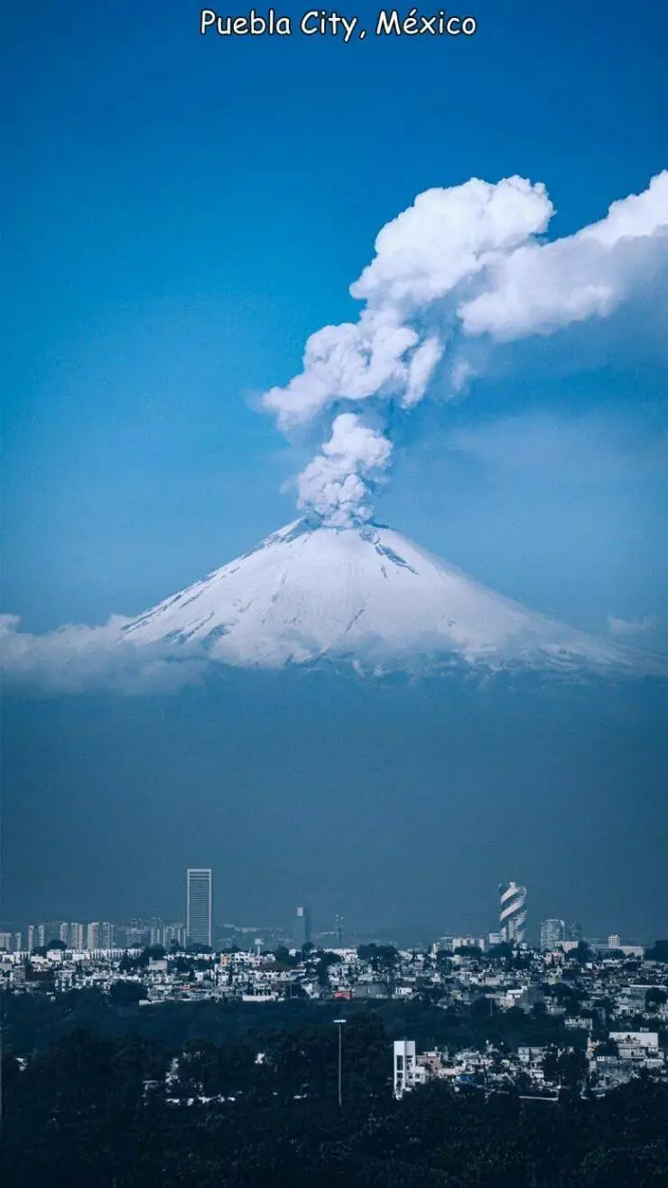
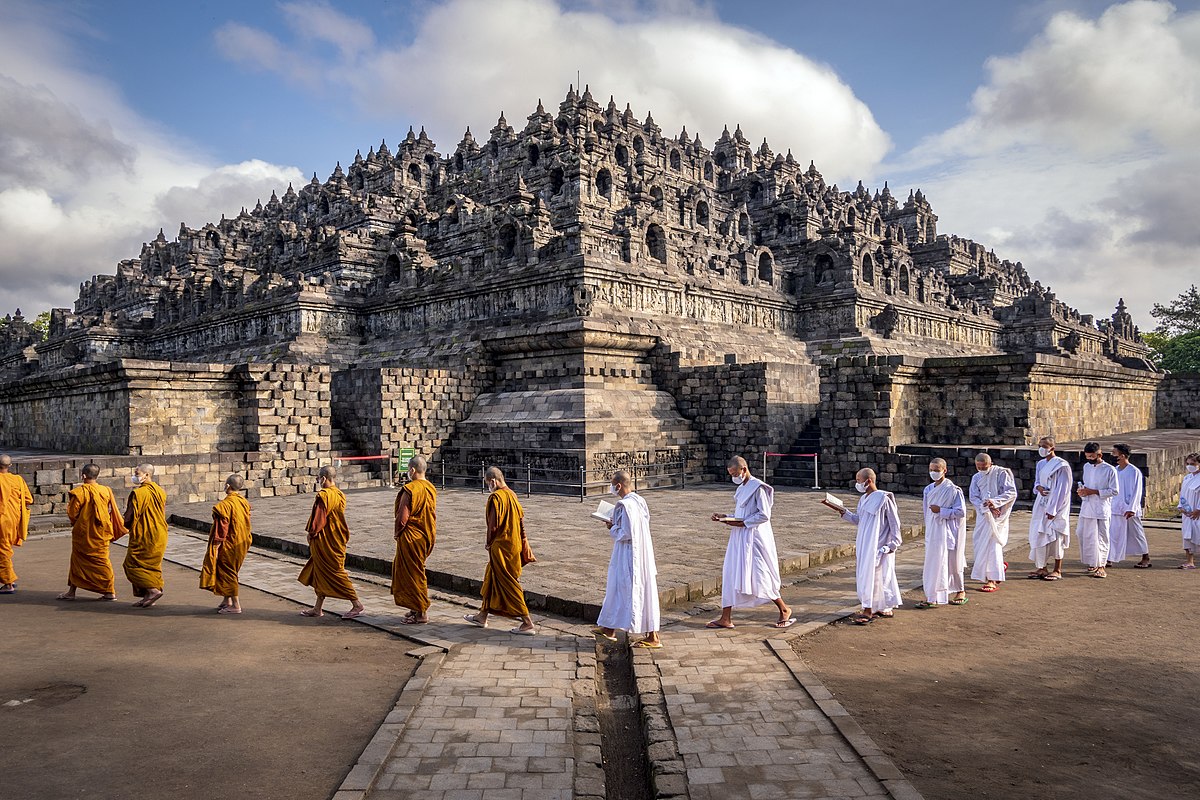
𝕕𝕚𝕒𝕟𝕖𝕒 November 1, 2024 4:34pm https://en.wikipedia.org/wiki/Puebla_(city) #places Puebla (city) - Wikipedia
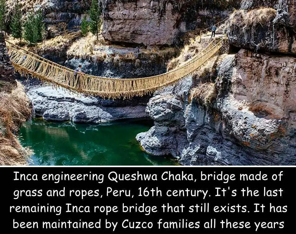
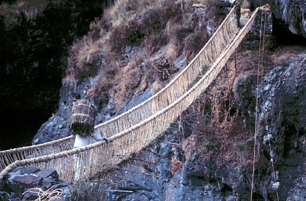
𝕕𝕚𝕒𝕟𝕖𝕒 November 1, 2024 4:32pm https://en.wikipedia.org/wiki/Queshuachaca #places Queshuachaca - Wikipedia
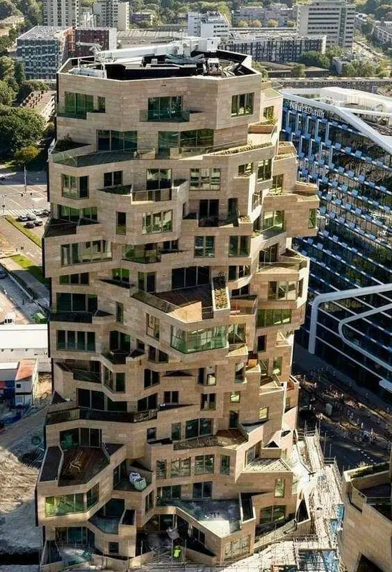
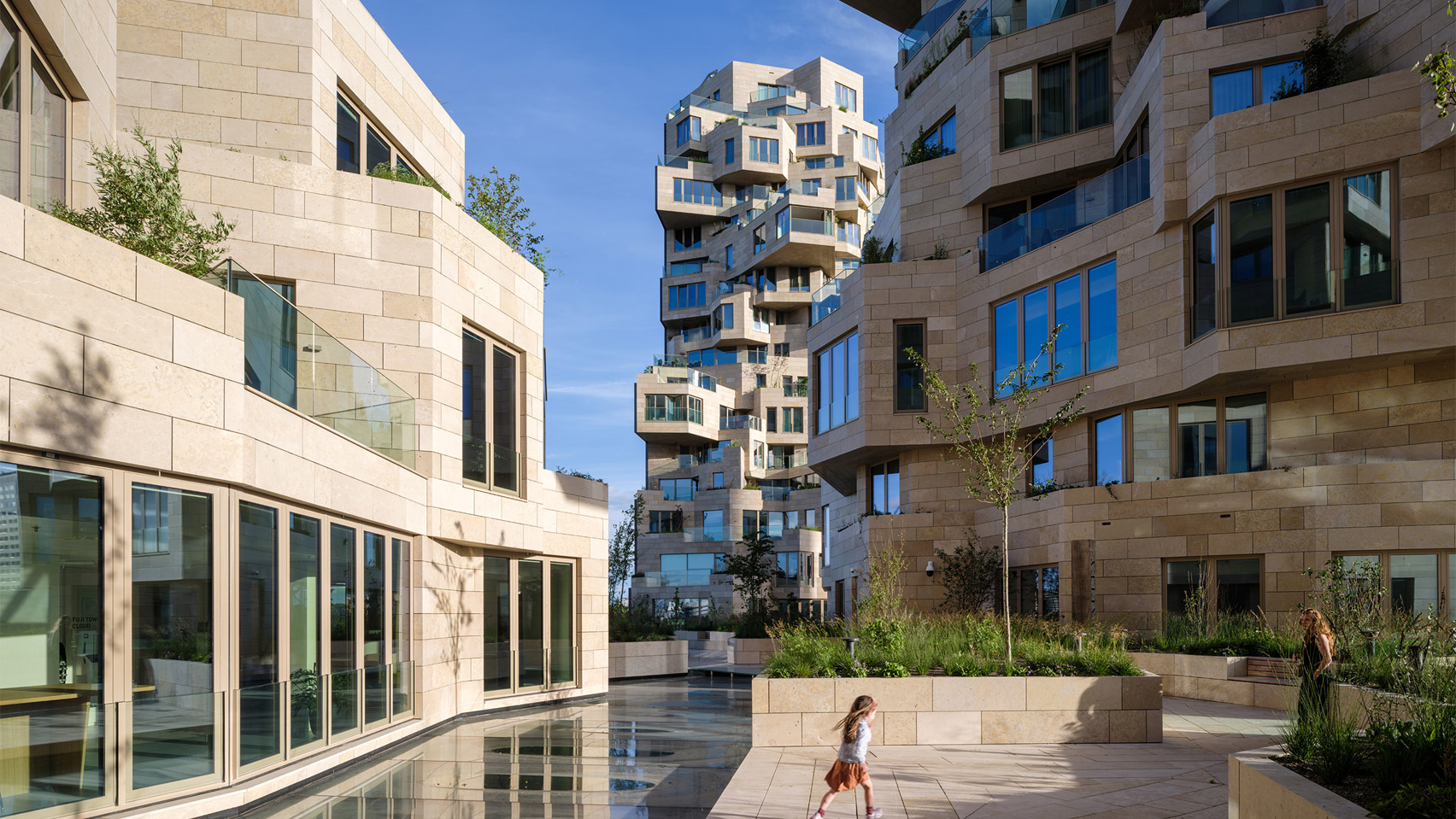
𝕕𝕚𝕒𝕟𝕖𝕒 October 29, 2024 4:28pm Valley Building in Amsterdam, Netherlands #places #architecture https://www.dezeen.com/2022/09/20/valley-skyscraper-mvrdv-open-amsterdam/ MVRDV's angular Valley skyscraper opens in Amsterdam A mountain-like angular skyscraper with jagged peaks named Valley designed by Dutch studio MVRDV has officially opened in Amsterdam, the Netherlands.
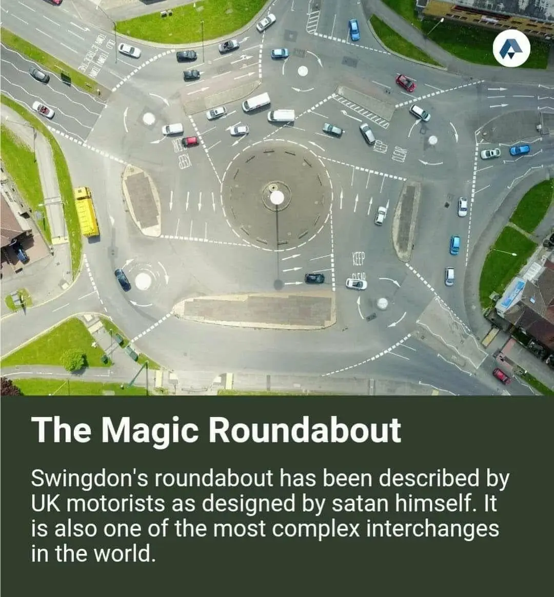
𝕕𝕚𝕒𝕟𝕖𝕒 October 29, 2024 4:24pm https://en.wikipedia.org/wiki/Magic_Roundabout_(Swindon) #places Magic Roundabout (Swindon) - Wikipedia
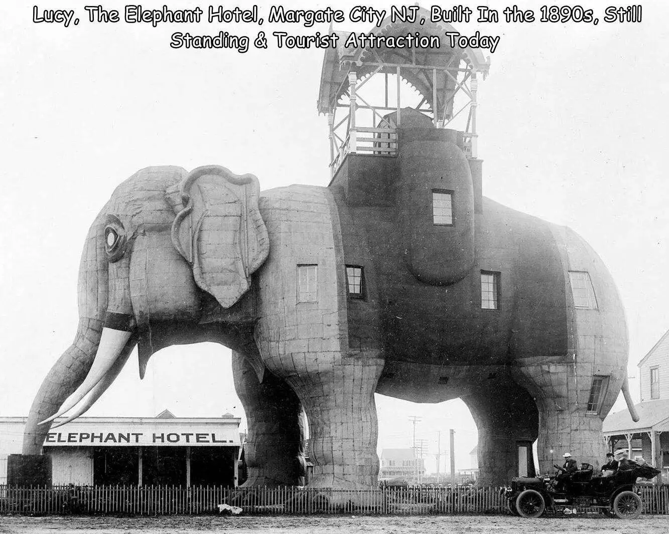
𝕕𝕚𝕒𝕟𝕖𝕒 October 25, 2024 3:50pm https://en.wikipedia.org/wiki/Lucy_the_Elephant #places Lucy the Elephant - Wikipedia
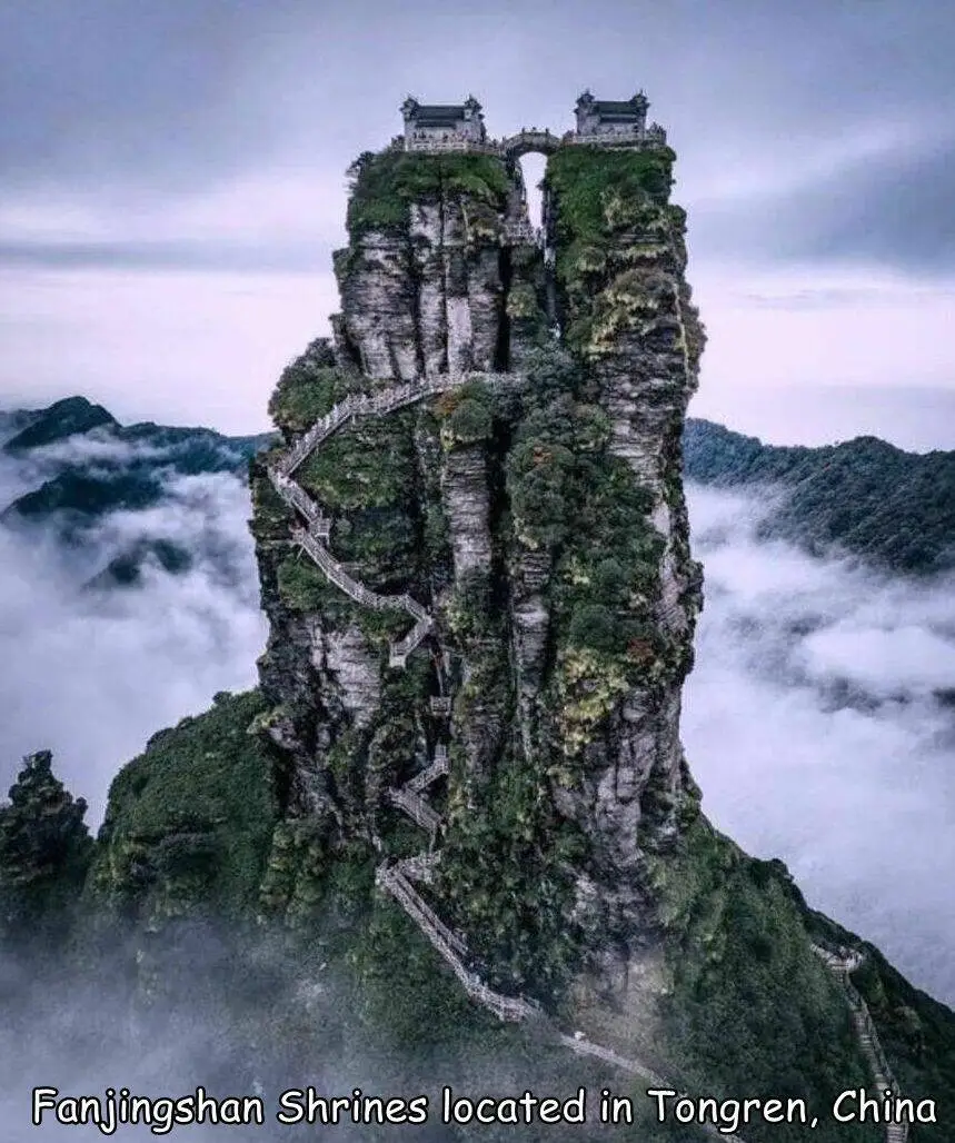
𝕕𝕚𝕒𝕟𝕖𝕒 October 24, 2024 8:47pm https://en.wikipedia.org/wiki/Fanjingshan #places Fanjingshan - Wikipedia
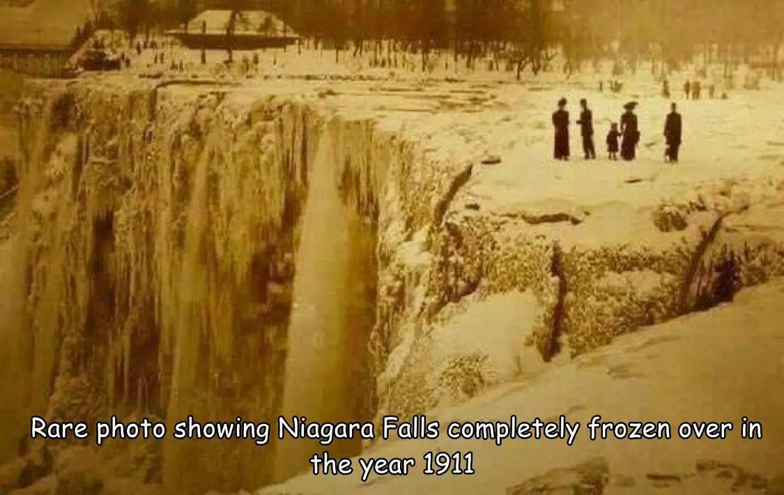
𝕕𝕚𝕒𝕟𝕖𝕒 October 19, 2024 10:18pm https://en.wikipedia.org/wiki/Niagara_Falls #places Niagara Falls - Wikipedia
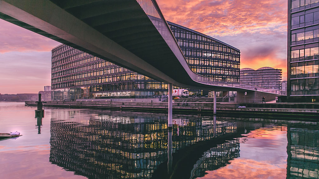
𝕕𝕚𝕒𝕟𝕖𝕒 October 15, 2024 2:47am https://www.visitcopenhagen.com/copenhagen/planning/bicycle-snake-gdk1087414 #places #bicycles The Bicycle Snake | Bicycle route in Copenhagen
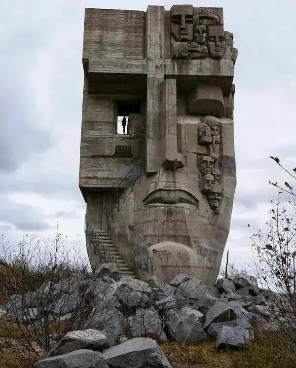
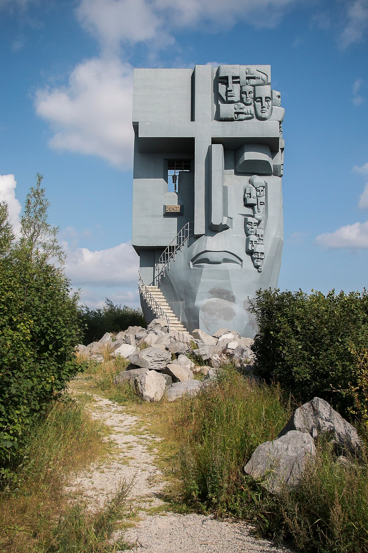
𝕕𝕚𝕒𝕟𝕖𝕒 October 15, 2024 2:07am https://en.wikipedia.org/wiki/Mask_of_Sorrow #places Mask of Sorrow - Wikipedia
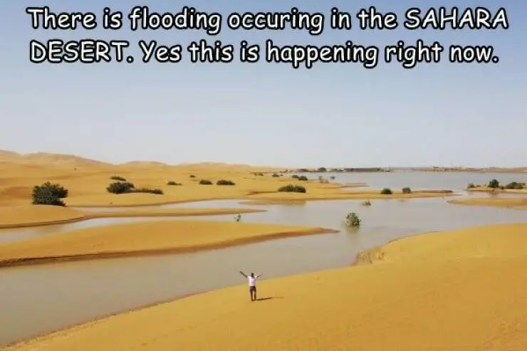
𝕕𝕚𝕒𝕟𝕖𝕒 October 11, 2024 4:46pm https://www.aljazeera.com/gallery/2024/10/8/a-rare-rain-in-the-sahara-desert #places Photos: A rare rain in the Sahara Desert Water gushed through palm trees and sand dunes after rare rain in the Sahara Desert in southeastern Morocco.
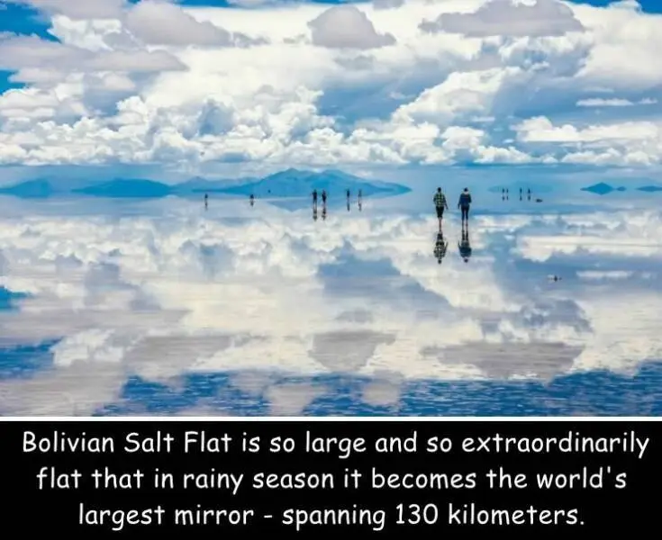
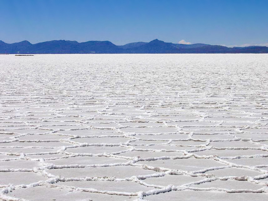
𝕕𝕚𝕒𝕟𝕖𝕒 October 11, 2024 3:38pm en.wikipedia.org/wiki/Salar_de_Uyuni #places Salar de Uyuni - Wikipedia
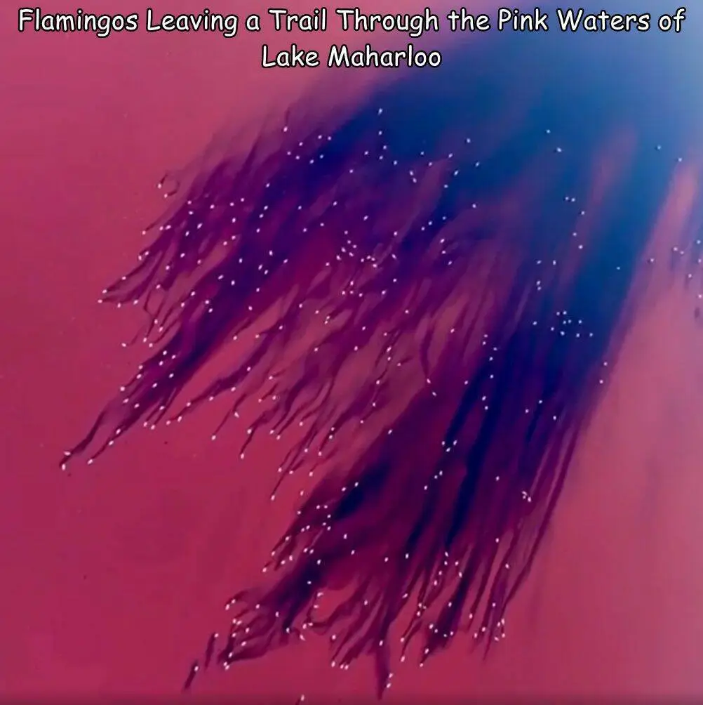
𝕕𝕚𝕒𝕟𝕖𝕒 October 8, 2024 4:55pm https://en.wikipedia.org/wiki/Maharloo_Lake #places Maharloo Lake - Wikipedia
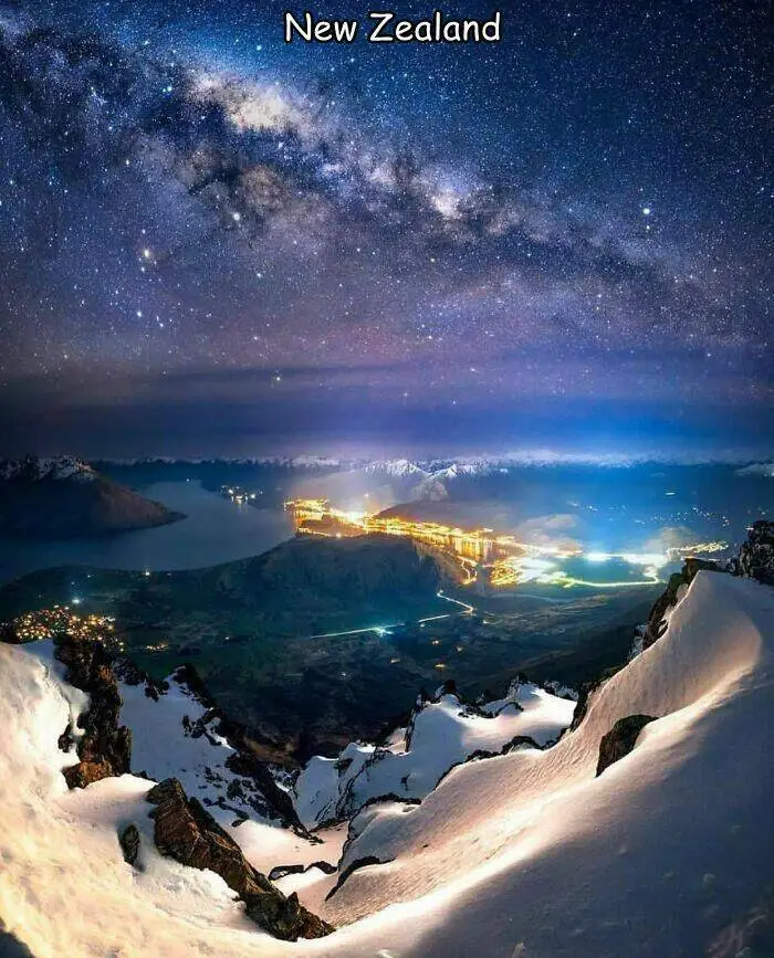
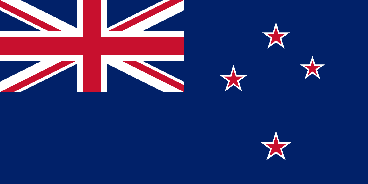
𝕕𝕚𝕒𝕟𝕖𝕒 October 3, 2024 2:00pm https://en.wikipedia.org/wiki/New_Zealand #places New Zealand - Wikipedia
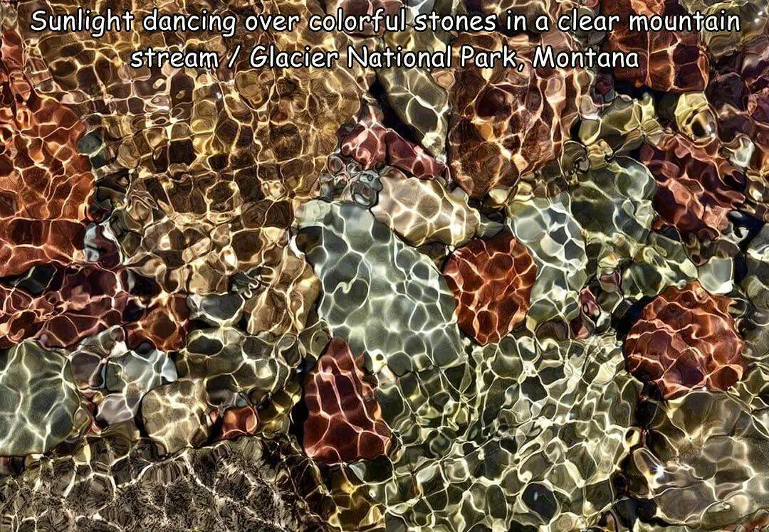
𝕕𝕚𝕒𝕟𝕖𝕒 October 2, 2024 3:08pm https://en.wikipedia.org/wiki/Glacier_National_Park_(U.S.) #places Glacier National Park (U.S.) - Wikipedia
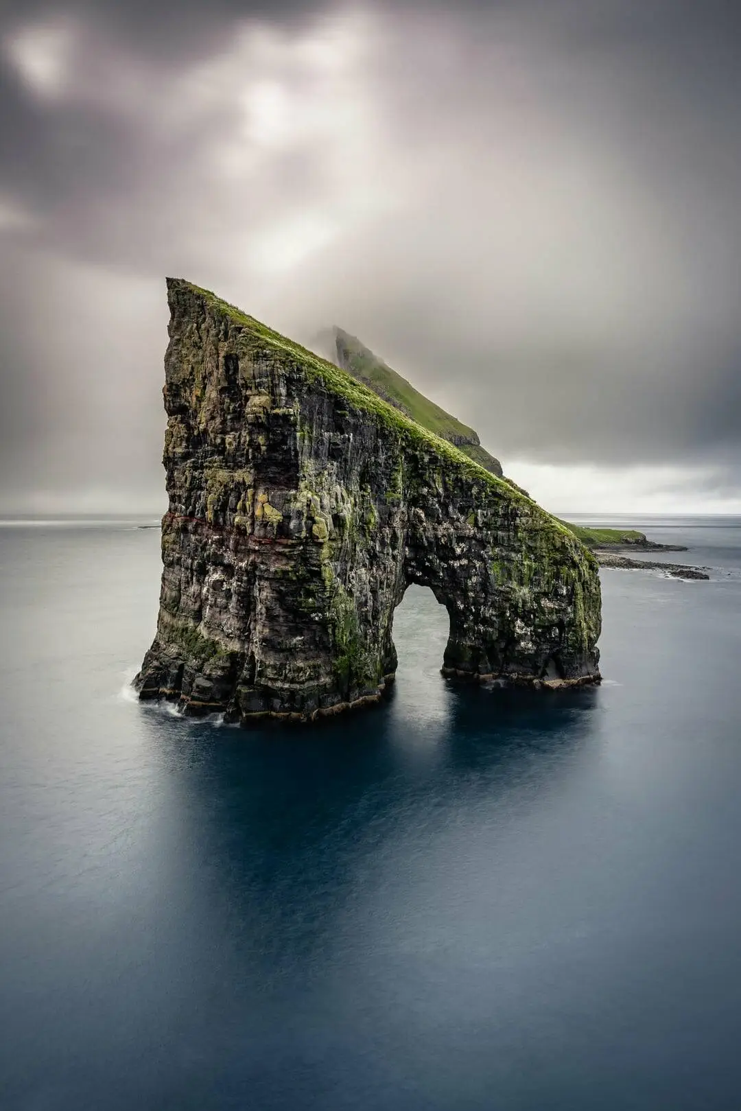
𝕕𝕚𝕒𝕟𝕖𝕒 September 18, 2024 7:32pm https://en.wikipedia.org/wiki/Faroe_Islands #places Faroe Islands - Wikipedia