3 Likes
1 Shares
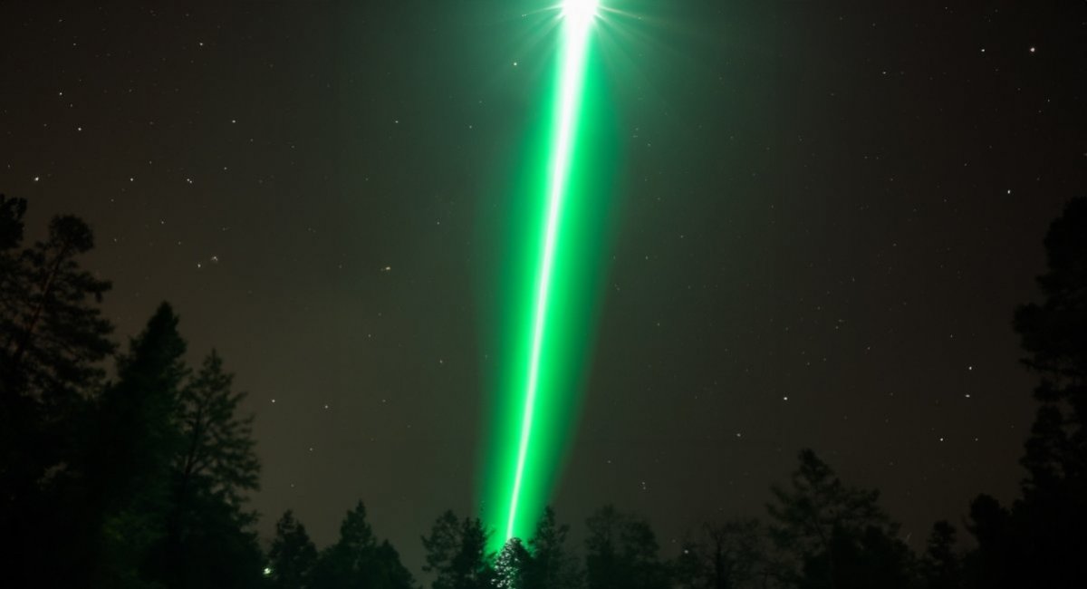
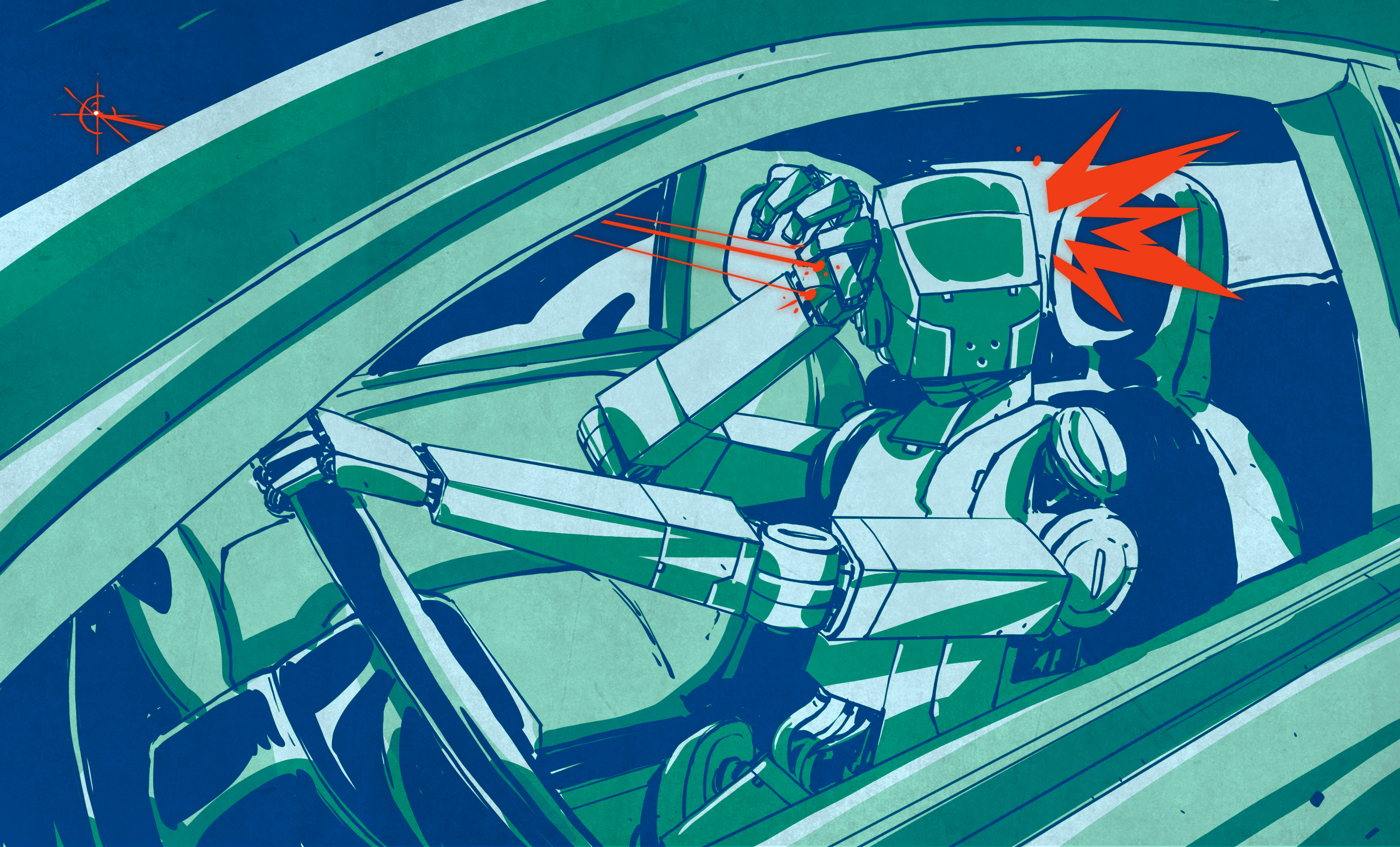
Green rays shine from the sky at night, slowly moving over the terrain, following vehicles or statically illuminating entrenchments
According to the description, they can be seen only at night, they move slowly but have been seen following vehicles or statically fixated in one area. All this happens in absolute silence.
#Ancient #Maya Cities Revealed By #LIDAR Connected By ‘Super Highways’ Revealed In Latest Survey
https://www.youtube.com/watch?v=OFBiV-2EUXk
Ancient Maya cities, ‘super highways’ revealed in latest surve
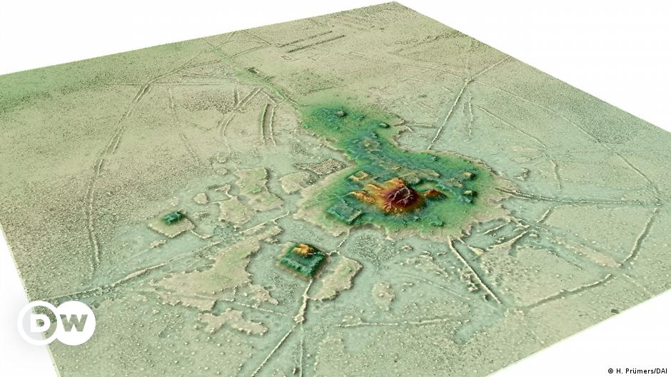
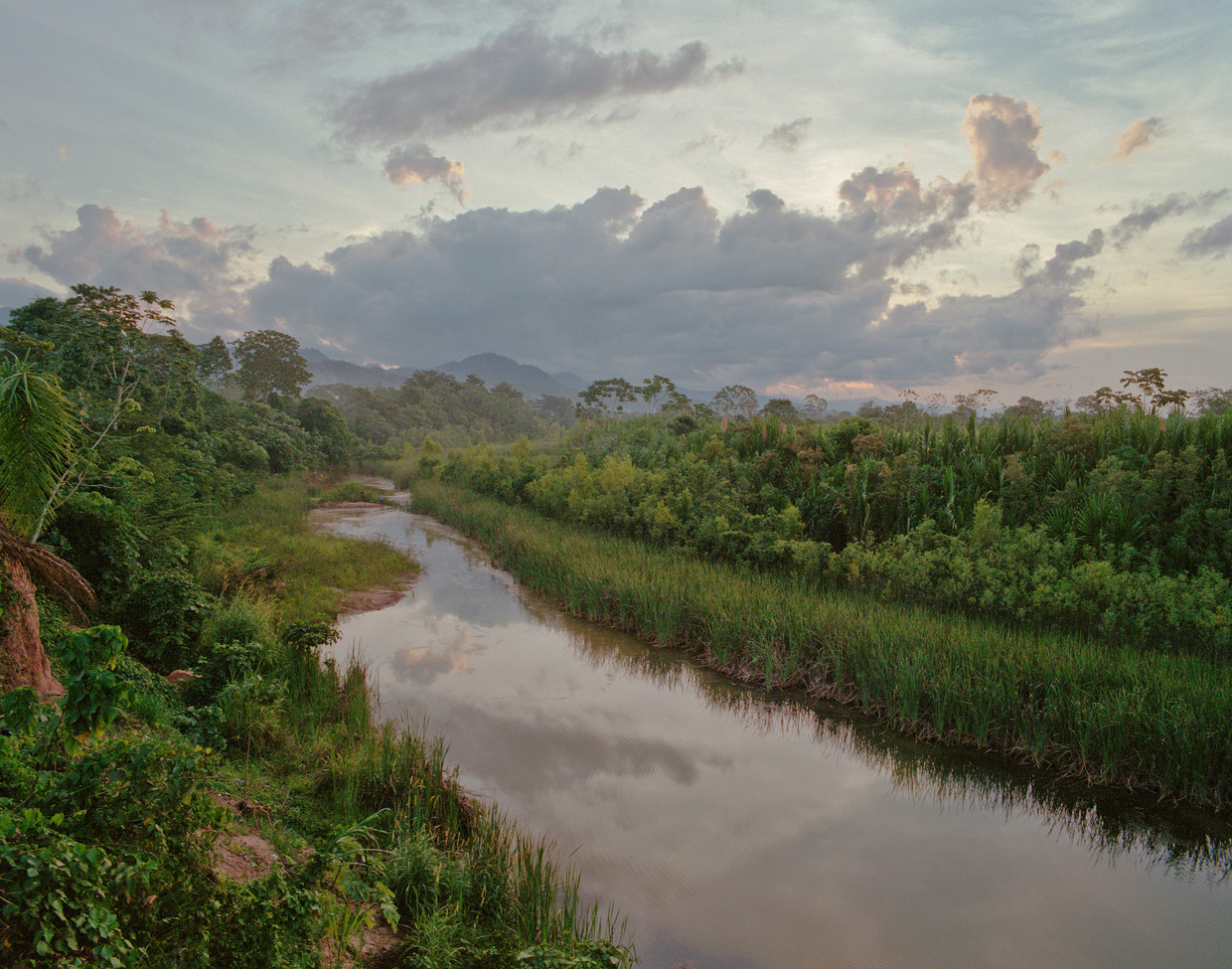
Die rund 1500 Jahre alten Siedlungen im Amazonasbecken widerlegen den Mythos, dass die Ureinwohner vor Ankunft der spanischen Eroberer als Jäger und Sammler in einer unberührten Wildnis lebten.#Amazonasbecken #Siedlungen #Lidar #Pyramide #Bolivien #LlanosdeMoxos #HeikoPrümers #DeutschesArchäologischesInstitut #Archäologie
Laserscans beweisen große Siedlungen im Amazonas-Regenwald | DW | 08.06.2022
De Volkskrant
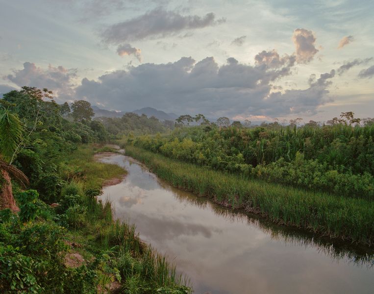
De Amazone was op sommige plekken tóch dichtbevolkt. Dat blijkt uit driedimensionale scans die Duitse en Britse onderzoekers hebben gemaakt vanuit een helikopter. In het Boliviaanse gedeelte van het regenwoud verschenen zo liefst achtentwintig steden en dorpen.
Het onderzoek doet verder afbreuk aan het beeld dat de Amazone vroeger grotendeels onbewoond was. De dichte begroeiing van het regenwoud zou de aanleg van drukke steden simpelweg onmogelijk hebben gemaakt, klonk het sinds de jaren zestig. Wetenschappers zetten daar sindsdien steeds meer vraagtekens bij, mede door de ontdekking van oude landbouw. Dit nieuwe onderzoek, dat woensdag verscheen in het wetenschappelijke tijdschrift Nature, toont voor het eerst een netwerk van steden in de Boliviaanse Amazone. De oudste steden, zo groot als sommige middeleeuwse Europese steden, stammen uit de vijfde eeuw voor Christus. (...)
Prümers wilde echter bewijzen dat het hele gebied waar hij naar keek, van zo’n tweehonderd vierkante kilometer, structureel was bebouwd met steden en dorpen. Hij gebruikte daarvoor een in de archeologie relatief nieuwe technologie, genaamd ‘lidar’. Net als een radar de omgeving in beeld kan brengen met weerkaatsende geluidsgolven, doet lidar dat met licht (daar staat de ‘L’ ook voor). (...)
De structuren die verschenen, waren overduidelijk door de mens aangelegd: in de grootste stad, een kilometer in lengte en breedte, stond een piramide van zo’n 20 meter hoog. Eromheen vonden de onderzoekers U-vormige structuren. Die lijken op de structuren in het Andes-gebergte waarvan bekend is dat ze religieuze ceremoniële functies hadden. Om het geheel lagen drie ringvormige, defensieve wallen, die laten zien dat de stad door de eeuwen heen is gegroeid, van circa 500 tot 1400. Ten slotte stuitte Prümers met zijn team op wegen, kanalen en grote waterbassins.
Het team bezocht deze steden en dorpen op de grond. Bij twee locaties deden de onderzoekers opgravingen en vonden ze keramiek en bewerkt bot. (...)
> Zie ook: Mysteries van de wereld: beschaving in het regenwoud op mijn weblog.
Tags: #nederlands #geschiedenis #amazone #amazonegebied #inheemse_bevolking #oorspronkelijke_bevolking #archeologie #bolivia #lidar #zuid-amerika
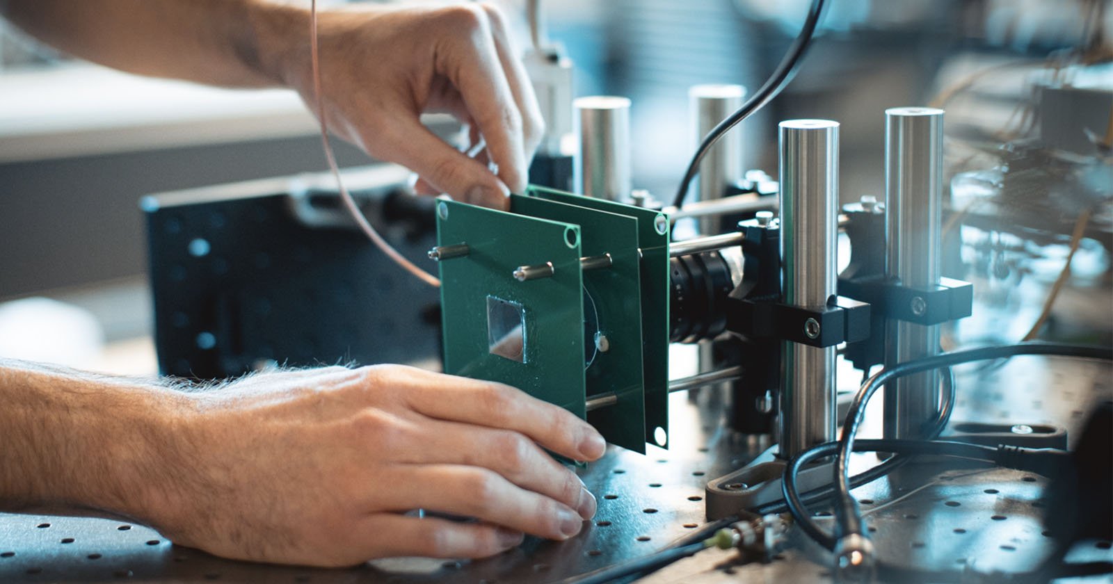
Researchers have developed a novel way to give any modern digital camera the ability to calculate depth with a low-power and compact optical device.
By "depth" they actually mean how far away things are.
#photography #LIDAR #Depth-Imaging #ComputationalPhotography

Could the light detection and ranging (LiDAR) sensors in your future smartphone take the place of laboratory equipment in health and food safety applications? It’s looking like a possibility.
Researchers at the University of Washington reckon handset LiDAR can determine fluid properties, sparing you from having to use expensive lab gear. The amount of liquid needed for a smartphone LiDAR test is significantly less than that for a medical lab, too, they said.
One application of LiDAR would be testing blood for coagulation. The researchers also found their method was able to determine the fat properties of milk and whether the liquid had been adulterated, and to identify a particular liquid from among ten samples.
The discovery, we’re told, let the researchers distinguish between coagulated and uncoagulated blood with only a single finger-lancet-sized drop, differentiate between different types of milk and whether the milk had been adulterated, and distinguish between 10 classes of liquid with 91.5 percent average accuracy.
See https://www.theregister.com/2022/03/18/smartphone_lidar_medical/
#technology #health #lidar #foodsafety
#Blog, ##foodsafety, ##health, ##lidar, ##technology
It provides a set of tools for editing, cleaning, healing, inspecting, rendering, texturing and converting meshes. It offers features for processing raw data produced by 3D digitization tools/devices and for preparing models for 3D printing.
As with anything 3D, there is a bit of a learning curve, but I did manage to select some “noise” in my iPhone’s 3D LiDAR images and clean those up a bit. They do have a series of YouTube playlist tutorials which should help, as well as some sample 3D scans to practice on.
See MeshLab
#technology #opensource #3Dscans #LiDAR #Meshlab

MeshLab the open source system for processing and editing 3D triangular meshes. It provides a set of tools for editing, cleaning, healing, inspecting, rendering, texturing and converting meshes. It offers features for processing raw data produced by 3D digitization tools/devices and for preparing models for 3D printing. MeshLab and PyMeshLab…
Will keep an eye on it, this looks look
#lidar #app
https://twitter.com/ShinichiTatsumi/status/1468146444918202371
🎄🎄 COMING SOON 🎄🎄
— Shinichi Tatsumi (@ShinichiTatsumi) December 7, 2021
ForestScanner -- an iPhone/iPad application that allows LiDAR-based tree measurement pic.twitter.com/xZAOjvUn5E
ToF is a measurement technique that relies on reflected light to quickly determine the distance of objects. ToF sensors are used in LIDAR (light detection and ranging) systems and in other applications that utilize SLAM (simultaneous localization and mapping) algorithms, all of which involve the analysis of the visible and near-visible spectrum.
These sensors have started showing up in smartphones recently – Apple's iPhone 12 and 13, and Samsung's Galaxy S20+, among others, include a laser-based Sony ToF sensor – for augmented reality applications and adding depth information to 2D imagery.
Now, four researchers based in Singapore and South Korea have another application in mind: They see ToF sensors as a way to spot concealed cameras.
Sami said he intends to release the source code for Laser-Assisted Photography Detection (LAPD) but has to coordinate that with his colleagues.
See Boffins find way to use a standard smartphone to find hidden spy cams
#technology #hiddencameras #spying #LIDAR

Smartphones now have lasers so we're gonna use them to find voyeurs