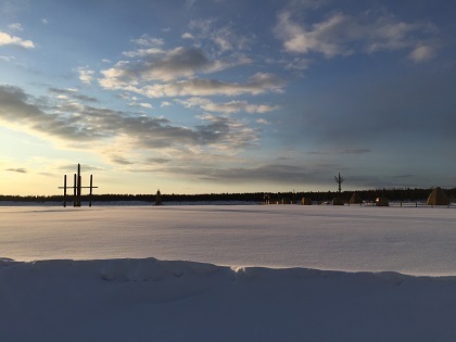
More than 2,000 people are deployed in extinguishing wildfires raging around Russia’s coldest inhabited territory, Yakutia, now in the third year of extremely intense season of wildfires.
The first of them ignited as early as the beginning of May right outside the world-famous Pole of Cold, the village of Oymyakon in northeastern Yakutia known for its record low temperatures.
Wildfires continued through May and June, with extra fire extinguishing forces needing to be sent from other regions to help republic’s own teams.
Today Kolyma highway, the major road connecting republic’s capital Yakutsk and the port town of Magadan on the Sea of Okhotsk, had to be shut because the fire got too close to the road and was much too fierce for safe driving.
After looking at the heat and subsequent fires in the Pacific Northwest, I looked through Nullschool's Earth viewer for other areas under peril.
The Yakutia region of Siberia is under a staggering amount of wildfire. The fires seem to have been burning since May, though by both particulate and CO channels at Nullschool, have exploded in size and intensity in just the past 48 hours or so (that would be after the dateline of this article).
Several videos on the article show conditions on the ground.
A snapshot of current conditions as noted by Nullschool:
Particulate channel, shows the location generally of smoke. I've selected the PM1 rather than PM2.5 channel as the latter is somewhat noisier, though it's generally what's used for smoke tracking. Both are fine particulate matter.
https://earth.nullschool.net/#2021/07/02/2200Z/particulates/surface/level/overlay=pm1/orthographic=-204.37,53.63,974/loc=135.098,61.931
CO channel, where carbon monoxide is a much more specific indication of where there is current combustion. These signal regions themselves are immense. My eyeball estimate is that this is roughly the size of the state of Oregon.
https://earth.nullschool.net/#2021/07/02/2200Z/chem/surface/level/overlay=cosc/orthographic=-204.37,53.63,974/loc=135.098,61.931
The region on Google Maps: https://www.google.com/maps/@61.9357692,135.147793,8z/data=!5m1!1e4?hl=en
https://siberiantimes.com/other/others/news/kolyma-highway-in-yakutia-also-known-as-the-road-of-bones-is-on-fire-and-temporarily-shut/
#wildfire #bushfire #siberia #yakutia #nullschool #ClimateChange #SiberianTimes