#ferns

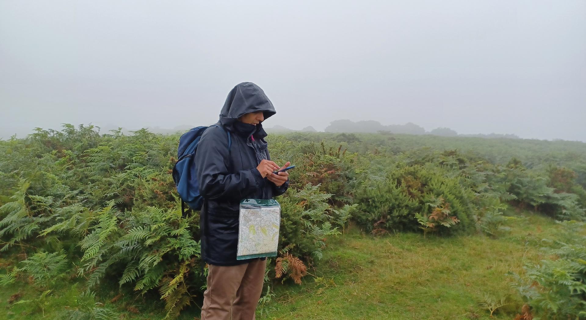
Having had two dry(ish) days in #BannauBrycheiniog, it is not surprising that that the third was wet and not by a little. I usually like using my paper maps and #DeadReckoning to #navigate my way around a new place but I forgot to bring my compass on this occasion and so I had to revert to #GPS (don't tell anyone else) in order to find #SugarLoaf near #Abergavenny. I couldn't see much else but at least our #hike was 12 km and so it was still worth it.
Here I am surrounded by #ferns trying to figure out where I should go in the #rain and #fog.
In the afternoon of the first full day in #BannauBrycheiniog, we travelled to #Crickhowell or #Crughywel to climb #TableMountain, which is also the location of an #IronAge #fort. So, equipped with my #OrdnanceSurveyMap we made steady progress up the slopes, on #roads and then #footpaths, often across #farmland. The total walk was 12.5 km.
Approaching the summit, you can see that the area is covered with #ferns.

Looking south from the summit, Crickhowell can be seen in the valley below.

On the descent, this is the profile of the western side of the mountain.

Also on the way down, here is a view looking west once more with the valley in the mid ground and hills in the background. Natural haze makes the distant mountains seem to fade away.

Here's a moment where the #Sun is shining through clouds giving an eerie effect in the fading light on a hill, while the foreground is silhouetted.

Today's Environment News India Update
Ranikhet inaugurated India's largest open air fernery: Uttarakhand
Leopard carcass found in Terai forest, electrocution suspected: Uttarakhand
Two alleged poachers nabbed near PTR: UP
NGT bench turning into saviour of environment in TN
Goa pulled up for mining notification without Supreme Court nod
🌱🇮🇳🌱
#india #factonews #environment #mining #news #government #supremecourt #BanMining #Ecology #environmentind #Fern #Fernery #Ferns #Forest #goa #Leopards #NationalGreenTribunal #NGT #OpenAirFernery #PilibhitTigerReserve #Ranikhet #SaveLeopards #StopMining #TamilNadu #UttarPradesh #Uttarakhand #wastemanagement #Wildlife #scienceandenvironment #science #conservation #health #water


