#cycling

jaywink@jasonrobinson.me

Cycling trip day 15

"De Oosterdriessen" camp site near Maastricht was really wonderful. Flexible arrival, friendly staff, good sanitary facilities and a great bar atmosphere. Can recommend!

Highlight of this day however was food. After packing up I cycled to Maastricht and launched the HappyCow app. Finally a big enough city with surely some vegan options. A fully vegan restaurant, yay! "Bar Verde" is about 1.5km outside the central area just south along the river, a really nice little ride. The place is beautiful, but of course food is what is the most important thing. "Plant based comfort food" is the theme. I had a "sate", which was pieces of tempeh joined with a really awesome peanut butter sauce. The nearby table claimed their vegan "cheese cake" was the best they had ever had, so obviously I had to stay for dessert as well. The tiramisu was to die for. So happy I visited this place, pretty much the best food I've had this journey.

Unfortunately it can be difficult for a fully vegan restaurant, especially a bit out of the center. Whether vegan or not, if you live in or visit the area, consider visiting the place and support their journey as a restaurant. "Lage Kanaaldijk 54", well worth the visit.

In terms of food, this day was actually my first fully vegan day on this trip since leaving Helsinki, having found vegan options also later in the day. It's been a challenge. I think the best thing was being offered salmon in a small French town when asking for "something vegetarian" from a boulangerie, where they spoke a little bit of English.

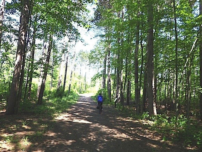
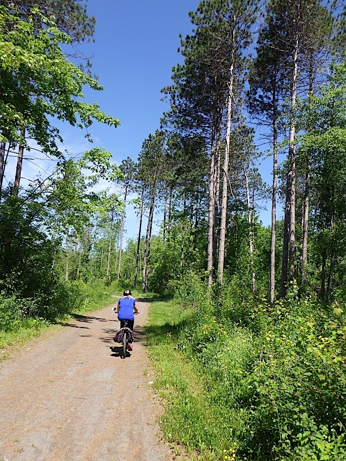
But, back to cycling. EuroVelo 19, going along the Meuse river, was my target. Unfortunately, I couldn't really manage to keep on it. Occasionally I found it, then the signs were confusing and I ended up just navigating north approximately in the right direction. The EuroVelo site allows downloading GPX files, but they're not only split into stages but also the stages are split into several parts. I just haven't figured out how to load even one larger part of the route into any app in a meaninful way, given the route has gaps.

Anyhow, doesn't really matter, as the cycling infrastructure in the Netherlands is just so awesome. Whichever route you take, you're guaranteed to be ok, so didn't really miss the EV19 that much. My only two complaints about today are: 1) too much head wind, the whole day was pushing against some pretty persistent wind from the north, and 2) hey it's unfrair that pensioners with electric bikes seem to just be strolling along while I'm having to grind for every singe kilometer. But also it's awesome to see so many cyclists of all ages <3

My target for this journey was "a minimum of 1000km", so yay, that at least is done. There is a possibility I could even reach Rotterdam.

Found a nice campsite between Roermond and Venlo. A few beers and the zzz. Tomorrow it will rain again.

Distance cycled: 86.72km (today), 1050.82km (total)

Ps. If you can only see a few photos, your platform is limiting the amount of photos on a post - if interested in all the photos, check out https://jasonrobinson.me/streams/tag/jasontravels/

#Travel #Bikepacking #JasonTravels #Cycling

ws01@diasp.org

2024-06-08: Hausrunde mit dem Rennrad, Bonn <-> Kirchsahr

2024-06-09:   82.2 km,  791 m up,  762 m down, 20.4 km/h

Der lief mir mitten im Kottenforst, auf halber Distanz zwischen Röttgen und Villiprott in aller Ruhe über den Weg.


Anstieg auf dem Villiper Weg (L267) hinter Burg Gudenau, Richtung Arzdorf

Das obligate Foto vom Anstieg auf der Hilberather Straße mit Blick zurück ins Rheintal, weiter oben wiederkäuende Kühe auf der rechten Seite


Vor Berg, immer noch teilweise unter Wasser gesetzte Wiesen

Die perfekt neu asphaltierte Landstraße L497 Richtung Kirchsahr schlängelt sich von Bäumen gesäumt entlang des Sahrbachs, mit dem Fahrrad ein Gedicht. Ich fahr' die 80 Kilometer eigentlich nur, um das Stück zu genießen. ;-)

Rechts das ehemalige Hotel/Restaurant "Zum Sahrtal"


Schon wieder auf dem Rückweg. In Neukirchen war Feuerwehrfest.

Ein Blick zurück: wer möchte angesichts der Sichthindernisse, welche die hier geparkten Lkw-ähnlichen Fahrzeuge darstellen, ausgerechnet mit dem Fahrrad auf diesem Sch(m)utzstreifen um die Ecke biegen? Jeder vernünftige und auf seine Gesundheit bedachterr Mensch nimmt diese Markierung als Hinweis, wo man auf keinen Fall fahren sollte. Wenn man zur Straßenmitte hin rechtzeitig einen großen Bogen schlägt, kann man frühzeitig in die Kurve hineinschauen. Ich hab' schon mal erlebt, dass genau im toten Winkel jemand auf dem Streifen stand und bei geöffneter Tür in einem Wohnmobil herumkramte.

Rechts: schon fast wieder @home, der Funkturm bei Volmershofen


Karte und Höhenprofil

Generell zur Fahrt: auf den Straßen und im Kottenforst war die Hölle los,nahezu jeder wollte wohl die Gelegenheit eines Sonnentages am Wochenende zu nutzen. Früher zog ich es vor, meine Touren wochentags zu fahren, um nicht mit Sonntagsfahrern jederlei Geschlechts und deren bizarren Verhaltensweisen konfrontiert zu sein. Während und nach Covid und mit Work at Home hatte es sich ein ein wenig abgeschliffen, aber das verliert sich inzwischen vielleicht wieder.

Bruttoschnitt diesmal 19,5 km/h, da ich kaum Pausen gemacht habe.

#hausrunde #bonn #kirchsahr #fuchs #kottenforst #radfahren #cycling #fahrrad #fitnessimalter #muskelmotor

jaywink@jasonrobinson.me

Cycling trip days 12 to 14

Have had trouble with laptop time to write these reports. Anyhow! Day 12 took me from Luxembourg to Bastogne in Belgium. I didn't intend to go the whole way, there were some camping sites on the Belgian side which seemed like good candidates, but unfortunately I messed up and didn't get there in time. The ride was through beautiful forests and fields, but also with a lot and lot of climbs. Legs didn't seem to have power at all. In the end I got to Bastogne at around 9pm, quickly finding a pizza and then onto the camping site.

Regarding the camping site "De Renval" there was no worry about arrival, it had a 24 hour self-check in, the first one I've seen. It also had the lowest Campy rating I've been at so far, a 2.7/5. So, expectations were not very high. Check-in went pretty well and generally seemed pretty ok in terms of sanitary facilities. Found the tent field with it already being a bit dark. One other tent, lots of space. Lots of birds making a lot of noise. Some geese maybe as well? The tent field was next to a pond. Oh.. Confirmed by looking at the bottom of my shoes, this field was full of shit - quite literally.

A problem for the morning.. Fell asleep with earplus stuffed halfway into my brain and slept really well.

Distance cycled: 97.77km (today), 812.46km (total)


Morning, day 13, stepped outside to confirm indeed, everywhere was geese shit. Just to prove the point, a family of geese were wondering towards my tent, honking away. "Fine, fine, I'll leave", I told them and started ninja-packing, a game of tip-toeing around the field and managing to pack everything without anything touching the ground. What the tent footprint looks like I didn't want to think about. Tried to wipe it a bit on clean bits of grass further away and fold it smartly, so the next night it would be the same side to the ground.

I wanted to join the EV 19, so while having lunch I was trying to figure out what next. Liège was the clear target, but it was 108km away. I felt physically very tired after yesterday. Sanna was also being increasingly noisy with a click sound happening when spinning the crank, also when spinning backwards while the bike was stationary. Bottom bracket? Difficult to say, seems worse when riding on a small gear.

Anyway, towards Liège was the only real option at this point. From two options, one going more through more forests and the other going more villages and on roads, I chose the latter option. Komoot claimed it would be a few climbs and then mostly downhill, but course over 100km the altitude graph isn't the most clear. It ended up being lots of climbs over hills and then lots of downhill sections, gradually going down some 300 or so meters during the ride.

The ride was super exhausting, every single climb feeling a pain, with legs really not wanting to do this ride today. However I did get the long windy downhill road sections today. Lots of them, some lasting several kilometers of simply letting go and hoping Sanna doesn't give up from underneath. Furiously gropping the handlebars and trying to avoid all the bumps and holes in the roads. At 50km/h one doesn't really want to hit large holes. Actually, I don't think I've ever gone this fast on a bike. Especially with two panniers and two fork packs, making bike handling in the wind somewhat special. At least I got my downhill sections, the ones I was hoping to do in Switzerland but missed them due to the rainy weather.

I would have stopped for the night before Liége, but there didn't seem to be great camping or hotel choices. Plus I told myself if I get to Liége, I can take an easier day tomorrow. With what seemed like endless amounts of pedal pushing I finally arrived around 10pm. Saw some bats on the way which cheered me up. Checked in at an Ibis hotel, convinced the receptionist to let me put my bike in the private parking garage, ate possibly the worst falafel of my life around the corner from the hotel and crashed into bed.

Distance cycled: 107.30km (today), 919.76km (total)


Day 14, a good nights sleep in a proper bed, I tried to remember last nights promise. Take it easy. Well I had to do laundry anyway, so off to circle the city center and find a laundromat. A few attempts and some hill climbing later ("hey, you promised us easy!" -legs), found a laundromat and got washing done. Have to say Liége while being a beautiful and really interesting city, wasn't the easiest to navigate around. Or maybe it was OSMAnd, trying to take me across all kind of weird road setups and even steps.

At 6pm I started heading off towards Maastricht and a camping site just before it. More broken promises to the legs, it was pretty hard head wind all the way and I was in a rush the make it to the camp site before reception closed. Regarding camping in general, I feel like the biggest issue for me is camping site reception times. Quite often you need to be there before 8pm or even before 6pm sometimes. For someone like me who wakes up late, has a lazy lunch and generally takes his time throughout the day, it's a bit of a challenge to also fit in a long ride and a camping site - feels like it's a "choose two" situation here. I do wonder what happens if you just go in and set up your tent anyway, and pay in the morning. Only one of the sites I've been to has had a proper gate, the others seem to only have a barrier, which of course as a cyclist is hardly a problem. Would they be ok or be mad? The few I called and asked if I could do this said it wasn't possible to arrive after reception hours for "security reasons".

The Netherlands! A restaurant with the waiter speaking good English! A menu with a vegan burger option! The vegan burger actually being really good! I'm sorry France and Belgium, but you made it really difficult for me in terms of food. Not being to understand any menu, not being able to ask about any menu and generally very poor vegan or even vegetarian options, at least in the regions I went through. Eaten way too much dairy, hoping for that to change while heading towards the northern parts of the Netherlands.

Poor Sanna is clicking away, but at least it hasn't gotten worse I think. Can't see anything externally broken. Could be just dirt somewhere, but possibly the massive amount of rain in the early parts of the journey did their damage. Might pop into some bicycle shops for consultation on the way but don't really want to stop for extensive repair time, if it can be avoided.

Distance cycled: 44.34km (today), 964.1km (total)


#Travel #Bikepacking #JasonTravels #Cycling

ws01@diasp.org

2024-06-08: Hausrunde mit den Rennrädern, von Bonn zum Walnußbaum bei Rheinbach

Um mit dem Ende anzufangen: diesmal haben wir uns zum Abschluss wieder ein großes Eis im Eisladen am Botanischen Garten in Poppelsdorf gegönnt. Da Garmin meinen Gesamtkalorienverbrauch auf 841 Kalorien abgeschätzt hat und ich während der Fahrt nichts gegessen habe, war das akzeptabel, denke ich. :-) Auch diesmal war die Baumscheibe ideal geeignet, dort die zwei Rennräder platzsparend abzustellen.

Das im Tourenbericht vom 23.5.24 kaum erkennbare Warnschild weit draussen im überfluteten Teil des Kottenforstes habe ich diesmal mit dem Telezoom besser abbilden können. Die überfluteten Bereiche sind nach dem starken Wind der letzten Tage, wie auch die meisten Teiche, nicht klar, sondern eine opake Brühe, wie ein grünlich angehauchter Milchkaffee. Abgesehen davon ist die Massierung an Mücken in den Bereichen kaum auszuhalten, ich bin da z.T. mit 30-40 km/h durchgefahren. Erstaunlicherweise habe ich aber keinen einzigen Stich davongetragen.

Die L113 ¹) war wie immer angenehm zu befahren, auch wenn diesmal wetter- und wochenendebedingt mehr Verkehr zu verzeichnen war. Die beiden Esel am Campus Klein-Altendorf wirkten in der Sonne etwas lethargisch und waren auf der Rückfahrt auch nicht mehr da. Etwas weiter draussen waren rechtsseitig zwei Quadrate mit Kantenlänge von vielleicht vier Metern ausgelegt, eines aus schwarzem Material, eines weiss. Zweck: Kalibrieren von Luftaufnahmen der Versuchsfelder. Ich hatte Mitarbeiter des Campus gefragt, die nebenan unter einem Sonnenschirm kampierten.

Der Walnussbaum steht jetzt wieder in vollem Grün, auf die Nüsse wird man aber bis zum Herbst warten müssen. Wir haben uns diesmal nicht aufgehalten, sondern sind gleich zurückgefahren. Diesmal war die Schranke am Bahnübergang zu, Gelegenheit für einen Schnappschuss der heranbrausenden S23, die zwischen Bonn und Euskirchen verkehrt. Nächste Woche fahre ich wieder damit, Fäden ziehen lassen.

Hinter der Schranke geht's dann über die Felder Richtung Flerzheim. Dann ein kurzer Aufenhalt auf dem sogenannten "neuen" Friedhof in Ippendorf und schließlich über Lengsdorf zum Eisladen. Fazit: eine schöne Tour, die wir gut gemeinsam fahren können, bzgl. Länge, Höhenmetern und Tempo ein Kompromiss, der aber Spielräume läßt. Ich halte häufiger an, sehe mich um, fotografiere, und hetze dann mit allem, was ich habe, hinterher, während sie kontinuierlich mit dem für sie günstigsten Tempo fährt. Das Navi, welches nicht nur die Karte und ggfs. die geplante Route anzeigt, sondern auch die Trittfrequenz und die aktuell getretene Leistung, ist dabei durchaus hilfreich. Da der Körper kurzzeitig mühelos bis zum Zehnfachen der dauerhaft aufbringbaren Leistung liefern kann und über fünf Minuten immerhin rund doppelt so viel, dann aber lange für die Regeneration benötigt, braucht man entweder viel Erfahrung, um dem entgegenzuwirken, oder entsprechende Messmöglichkeiten.


¹) L113 im Schnelldurchgang: ein 20fach beschleunigtes Video der L113 aus 2021

#hausrunde #bonn #rheinbach #radfahren #cycling #fahrrad #fitnessimalter #muskelmotor

jaywink@jasonrobinson.me

Cycling trip day 11

Around half way, OMG. Time does fly.

Originally, my plan was to just gently dip into Luxembourg and then head on towards the EuroVelo 19 route, but I decided to go into Luxembourg city instead. I can join the EV 19 later at some point.

With renewed faith in navigation, ie actually being able to see the route, climbs and surfaces clearly on Komoot, I head out from Metz along the canal. Smooth as butter, with a nice cool temperature as well.

Stopped at Thionville for some food before the climbs into Luxembourg. Seemed a really nice place on the banks of the river Moselle. Especially liked the rather extensive car free city center. Unfortunately the car drivers outside the center didn't seem that welcoming to bikes. Some rather aggressive car drivers passing by while I was navigating out of the city, even receiving the first honk. Reminded me of drivers in my home town Helsinki. "Get off the road cyclist, I have to be somewhere else than I am now really quick, and if I lose seconds something awful will happen" -mentality. Maybe have some bike lanes if you don't want cyclists on the road?

I don't know why but it feels like generally also while getting closer and into Luxembourg the cars seemed to be driving faster and the roads seemed to be less welcoming. I didn't even realize until looking at the map where the border had been, but what I do remember is it being a somewhat busy part of road with climbs and without a curb. On the Luxembourg side this didn't change. For this trip, today has been a day with a lot of cars and a lot of busy roads with a lot of drivers seemingly in a rush to be somewhere else. Apart from the honk meant for me in Thionville, I hadn't seen aggressive driving during this trip. While navigating to the center of Luxembourg I heard a lot of honking along the at times very stationary queues of cars. On a motorway, from a bridge crossing it, taking a photo of a queue on one direction, a lorry driver was having a rage at a car driver on the other lane. I can't help than think that Luxembourg is in love with cars and especially sitting in cars, queuing to get somewhere. The queuing surely can't be for the lack of roads or lanes, based on the small part I saw. Of course, could just be the "it's a big city" -thing too.

For cycling, arriving from the south it was partly dedicated (or shared for farm access) cycling paths criss-crossing roads or then cycling on roads. Nearer to Luxembourg central things turned very city like in terms of cycling traffic. Partly on the road, partly on various types of dedicated or pedestrian shared cycling paths. Crossed a scary and cool very high bridge which had the cycling route built underneath the bridge. Awesome and "please don't let me die" at the same time. I don't do heights very well. Lots of commuter cyclists were going around, which was nice to see.

Had some food and beers, then backtracked down south some 6km to the camping site Kockelscheuer. I really can't recommend this site enough. Reception open until 10pm (which is the latest I've seen), actual warm shower building, restaurant open until 10pm and awesome friendly staff. Plus obviously near the city center too. Additionally, this is the cheapest camping site I've been to on this trip, only 14€ for a tent pitch.

My only concern at this moment is Sanna has started to get a bit noisy in the recent days, with the noise getting worse. Not the same as before the trip, so not the seat post I think. Possibly just dirt somewhere? I think I took half a field with me on the way from Nancy to Metz.

Btw, for followers on platforms that restrict the number of photos on a post (Mastodon?), you can see all the photos at https://jasonrobinson.me/streams/tag/jasontravels/

Distance cycled: 83.01km (today), 714.69km (total)

#Travel #Bikepacking #JasonTravels #Cycling

jaywink@jasonrobinson.me

Cycling trip day 10

Caught up with some lost sleep by not putting an alarm at all, woke up around 11am at my friends place. Shower and a few coffees later some breakfast and then onwards to Metz, today's target. Easy, casual ride, I was thinking, along the canals just like yesterday.

Garmin had other plans. Soon diverged from the canals into a beautiful forest. Nice, I thought, I don't mind the change from yesterday. Cycle way changed into small country roads, which also felt like a nice change from yesterday. After a few kilometers on a busy road with large trucks I decided to look where it was routing me. Somewhat annoyed to realize it had routed me on a longer route around the countryside, possibly due to being in "road" routing mode. Gutted it took me over 25km to realize what was happening.

I really didn't want to get squashed under some truck wheels so I decided to change plans and start heading west towards Metz using smaller roads. Unfortunately, switching the Garmin to "mixed surfaces" and pointing it to a small village with a shop nearer to the direct route, meant I now got routed through literal fields. Like, actually going through overgrown tractor paths for a few kilometers, knee deep in vegetation. I'd be surprised if I didn't pick up any ticks during this part. Sanna still has wheat or something stuck to her.

Shortly after the fields episode I managed to find a small village shop, had some snack and decided I've had enough of the Garmin built-in routing. It's not that the navigation itself sucks, but there is literally no way to control the route by placing things like waypoints, and it's a lot of extra effort to view what kind of route it is suggesting, from the small screen. Like in this case, it was completely different from what OSMAnd would have taken me through. So I decided to swallow my pride and finally buy the Komoot package costing 30€, which allows building routes on Komoot and using them on the Garmin. Well, in theory. Apparently you can't do this in the middle of an activity, which is just insane. Except you can, if you transfer the route through the Garmin Connect app, if you have linked Komoot to it. UX fail, yay. Anyway, hopefully better control over routes from now on.

Rolling hills, small villages, lots of wheat fields. This was supposed to be a chill ride but ended up being over 90km of lots of hills, totaling almost 1000m of climbs today. At least I got to see lots of pretty French fields during the day :)

Finally made it to Metz around 9pm, found a restaurant for food and beer, and proceeded to book a hotel. Getting into a camping site would have been too much hassle this late.

Distance cycled: 93.09km (today), 631.68km (total)

#Travel #Bikepacking #JasonTravels #Cycling

jaywink@jasonrobinson.me

Cycling trip day 9

Finally, a day completely without rain! Even got some sun after getting closer to Nancy.

One thing I've learnt during this trip is to not try and wash too much laundry at hotels if you only have 12 hours or so for them to dry. It's just not going to happen. This time I only washed the stuff I was going to wear today and even they didn't get completey dry. With the help of the hair drier got them good enough to wear, since the weather was dry they soon fully dried up on the road.

I was met with a pleasant unplanned surprise leaving Épinal. The route to Nancy was pure cycle path, running in between the La Moselle river and Canal des Vosges. These two crossed a few times, with the canal going over the river on a bridge. Wild! Rivers on top of rivers, because why not. The ride was stunningly beautiful the whole way, with the beautiful canal on one side and La Moselle often visible on the othe, lush trees, bushes and flowers all around.

Almost drove over a snake! Coming around a corner it was possibly crossing the cycle way and just managed to miss it with my front tire. I hit the brakes after passing it and saw it slither into the safety of the bushes.

Lots of other bikepackers also going in both directions. I'm still not quite used to the fact that especially with other bikepackers, you're supposed to greet them when passing. Well, near Épinal everyone was bonjouring me as well. I was probably seen as a countryside idiot getting closer to Nancy and still bonjouring other cyclists.

At beautiful Nancy I spent a bit of time admiring the big central park (Parc'de la Pépinière), then settling on a terrace for some good local IPA. Today I was meeting my friend Victor here for a drinks, a meal and some rest at his place. Fancy to be able to sleep as long as one wants next morning! 💚

Distance cycled: 81.85 (today), 538.59km (total)

#Travel #Bikepacking #JasonTravels #Cycling

jaywink@jasonrobinson.me

Cycling trip day 8

Didn't get much sleep. Heavy rain was rattling on the tent the whole night and the birds in the nearby trees had decided to have a big party it seemed. It was also raining heavily in the morning when I needed to start packing up. This meant I had to pack up the tent completely wet. Next night would need to be a hotel room to dry things.

Completely drenched I rode down to the nearby town Le Thillot for something to eat. Apparently the town had a festival today, lots of food stalls and music shows, including one straight from a US western. Had a nice brunch at a boulangerie and wandered throughout the stalls for a bit.

The rain that had paused for a while picked up as I set out towards Épinal. The first 25km or so was a really nice cycle way down through the valley. The rain was coming down quite heavily but my shoes and shorts were already completely wet from yesterday so I felt like not caring and didn't even bother to put on the rain gear.

Towards Épinal the cycle way turned into roadside cycling, but at least the weather started drying up. Most of the ride was downhill so very little effort and a lot of time to look at scenery.

Épinal is a really nice small town, sitting on the majestic Moselle river. Since I had lots of wet gear I took a cheap room at the central Ibis hotel and spread out everything around the room to dry. Found a snail that had hitchhiked within my tent footprint, and still alive. Gently moved the little one outside on the window sill. Hopefully it wasn't something that will totally demolish the Épinal area wildlife 😅.

Went for a few beers before crashing in bed. The river looked beautiful at night <3

Distance cycled: 57.84km (today), 456.74km (total)

#Travel #Bikepacking #JasonTravels #Cycling

jaywink@jasonrobinson.me

Cycling trip days 6 and 7

Day 6, woke up refreshed at the hotel at Nesslau, but totally messed up with the laundry. Everything was still wet. And it was still raining hard outside. And based on the forecasts, the rain would continue the whole day all over until Basel.

I was kind of looking forward to the downhill riding into Zürich, and also my plan was to vote there in the EU elections, but spending a few hours riding downhill on wet roads with cars constantly splashing water didn't seem worth it. So, I switched my plan into doing a train day. From Nesslau I got a local train to Watwil, from there a regional to Luzern, where I stopped to do laundry at a self-service laundromat, then another regional train to Basel. The Swiss local and regional trains are really nice, plenty of space for bikes and with easy access too. A tad bit expensive, cost 80€ for these 3 trips with a bike.

Due to extremely wet pavement I slipped in Luzern while trying to make a hasty U-turn while navigating towards the train station. Hit my right knee on the ground, not hard enough to do any damage but hard enough to open a previous wound that had just healed. Camping with a wound on your knee is rather annoying due to needing to crawl around a lot, so went to buy some large patches before jumping on the train.

Tomorrows weather forecast said the rainy area would end just north of Basel, so I reserved a hotel with 24 hour check-in at a place called Wittersdorf, which was a 42km ride into France. The drizzle in Basel slowly turned into dry and it was quite enjoyable riding through the French countryside with at times nothing else visible than the edges of wheat fields. I used to be afraid of the dark still in my thirties, but these days I've learned to like the peacefulness of midnight rides. As long as you have a light with you and it's not pouring down. Saw a badger and some other animals.

I am going to have to stop listening to the Garmin navigation in rainy weather though. This time, a few kilometers before the hotel, it decided that I should take a shortcut through a wheat field. What looked initially as an ok "unpaved road", turned into an outgrown tractor path "unpaved road", with slippery, sticky, gray mud. Probably got Sanna more dirty during the under kilometer of this than the whole 40km before.

The Hotel Restaurant Kuetz was an interesting roadside place. Very old building, lots of statues and pictures of Napoleon. The claimed 24 hour reception apparently meant "call this number and we'll wake up". A somewhat half-asleep employee answered the phone and for a while I had difficulty explaining "I'm at the door". The word "reception" finally hit a bell and I was let in. Google Translate to the rescue, managed to also get my bike into safe storage and happily got into the room and crashed into bed.

Day 6, distance cycled: 44.58km (today), 289.17km (total)


Day 7, had a heavy breakfast at the hotel and headed up towards the Vosges with a plan to cross them and get as far north-west as possible. A large rainfront was on its way and I didn't want to get stuck in it. Things were nice and dry until Belfort, where I stopped for a small lunch and coffee, then drizzle started.

While riding upwards towards the Vosges, I suddenly started realizing the increase in road bikes, and especially groups of them, going in both directions. Soon it became apparent I had ended up on the route of a bicycle race! Got some cheers from other cyclists and their crew on the side of the road. Talking to a few Dutch cyclists, apparently this was a yearly event mostly for fun, riding 80km, including a climb that has also been a part of Tour de France sometimes.

"Unfortunately", I couldn't do that climb, as it would have taken me into the wrong direction, so I parted ways to do my own climb. This was going to be 793m upwards to the peak of one part of Vosges, into 1150m of altitude. The climb lasted 8km or so, and there were more than one time I was just ready to give up and go back down. I demolished probably around 5 snack bars and almost 3 bottles of water just on the single climb. Reaching the top was a bit of an anti-climax. I was literally in a cloud and it started pouring down heavily as soon as I came to the peak.

Riding down was almost as hard as going up. Instead of being able to relax, the extremely wet road and bumpy asphalt required constant concentration, with the breaks being in constant use over the 7km of descent. With the slip in Luzern in mind, I didn't want to test how far the front tire can be pushed with the fork bags loaded on it on a wet road.

The camping site "L'Orée Du Bois" near Le Thillot, which I had called to ensure for availability was super flexible, and when I got there the somewhat tipsy receptionist lady and the rest of the campsite crew were happily enjoying some wine on their restaurant terrace. I was immediately offered a beer and made friends with the campsite dog Spunky. Given I hadn't eaten any large meal and had spent almost 4K kcal during the ride according to Strava, was heartwarming to also get a restaurant place arranged nearby, just before their closing. Quick change into dry clothes and then into a fancy restaurant, which of course had nothing that didn't contain meat. The fish I ordered came with the head and skin still attached - it's been a long long time since I've eaten fish in this way. Unfortunately it wasn't particularly great compared to the €23 price, but at least it was food and I also got to have a few glasses of wine before heading back to set up camp.

I'm really happy about the MSR Hubba Hubba NX2 tent and the way it allows setting up in rain mode. Getting quite good at it due to this stupid weather, the only wetness that got inside was from the drenched bags carried it. This time had to do it in pitch black darkness, but due to my headlamp that wasn't an issue.

Finally, sleep, with heavy rain dropping outside, too tired to even brush my teeth. Today I did both my longest ride ever but also a new climb record \o/

Day 7, distance cycled: 109.73km (today), 398.9km (total)

#Travel #Bikepacking #JasonTravels #Cycling

jaywink@jasonrobinson.me

Cycling trip - day 5

Today I did a thing I had not done before.

But first, the morning. It had rained all through the night, keeping me up at times. In the morning though there was a window of a few hours of sunshine, just as I needed to start wrapping up camp. Got most of the things dry in the sun and hastily exited towards a restaurant for lunch, as the drizzle started coming in.

My route would take me towards Basel and originally I was going to go through some valleys with "only" a few hundred meters of climbs. But Garmin wanted to suggest a marked cycling route further north, so I took that. Of course what it didn't tell me was that soon after moving from Liechtenstein to Switzerland, I would need to ascend over 700 meters, during a climb lasting a total of 10km. When the climb popped up on the Garmin it was too late to choose another route, but also I'm quite easy to sway into an adventure, so up it is!

Slowly, one rotation at a time, sometimes up to 11%, I fought up the windy road, cars zooming past. As this was a cycling route, clearly signposted as such, I was hoping the drivers were used to slow moving cyclists pushing up towards the top, so didn't feel too threatened. What did start feeling threatening was when I was a third up the heavy rain started, and soon also thunder. Does thunder sound different when you're close to a kilometer up from sea level? It sounded more ominous, possibly due to all the low clouds covering half of the distant mountains.

Wet, tired, a bottle of water and quite a few snack bars down, I did finally make it to the top. And it was possibly the most rewarding thing. The sky was also clearing and a restaurant serving pizza came up, so I decided to reward myself with a pizza and beer. This was by far the largest single climb I've ever done and I'm super happy that even though the weather was poor, I managed to do it.

The rest of the planned ride, ending up somewhere near Zürich, was going to mostly be downhill. But alas the sun didn't last. Before I had finished my pizza, the rain was back, at least as angry. Having spent so much time riding in the rain and everything being muddy and wet again, I decided to call it a day and reserved a room at a hotel 8km away at a place called Nesslau. I was looking forward to the downhill section but now it was just annoying. Completely drenched, rain pouring down and fast moving cars spraying water everywhere, some of them passing by rather too close for comfort on the larger two-lane road. For some reason using the other lane for taking over is sometimes impossible if a cyclist is being taken over by a car. Maybe car steering wheels are sometimes really stiff and getting onto the other lane is just difficult, what do I know.

Hotel is very nice at least. Got my laundry done and all the camping gear spread out to properly dry. Tomorrow hopefully Zürich and potentially beyond, if the weather doesn't ruin things. Scenery is so beautiful here and have passed many nice villages, but all the train is taking a bit of the enjoyment out of it.

Distance cycled: 44.76km (today), 244.59km (total)

#Travel #Bikepacking #JasonTravels #Cycling

jaywink@jasonrobinson.me

Cycling trip - day 4

Lazy morning, slept well, caught up with some of the lost sleep of the last night. Weather forecast said rain at around 5pm, so after breakfast I headed off towards Vaduz in Liechtenstein, hoping to make it before rain.

The cycling infrastructure is awesome here! Lots of people cycling, of all ages, and not just tourists. And tbh, the whole valley into Vaduz was flat as a pancake. Good quality cycling paths following the canals and crossing the fields. With the mountains drawing nearer and eventually being all around, it was a nice ride in cloudy but warm weather.

The route to Vaduz took me inside Switzerland for a bit and also to a Swiss mobile network. I suddenly got a bit of a shock, I had not prepared for the fact that Switzerland of course is not in the EU and thus does not have the same 37GB per month of roaming data I can use all around the EU. I bought a 1GB package for €25 (Elisa moster prices) and switched off mobile data unless needed for something. I also didn't realize I may need Swiss Francs and a power adapter (Liechtenstein shares both with Switzerland).

Had a burger and a few beers in Vaduz, which was already full of tourists, and then headed 8km south to Camping Mittagsspitze, who over the phone told me not to hurry and just set up my tent even if the reception is closed, and pay in the morning. It was raining somewhat hard again on the way to the camping site so I had to set up the tent in "rain mode". Went pretty well this time, was a good idea to practice this in Finland before leaving.

Distance cycled: 66.32 (today), 199.83km (total)

#Travel #Bikepacking #JasonTravels #Cycling

ws01@diasp.org

2024-05-28: Kreuzbergrunde kurz

Die kürzeste Hausrunde seit langer Zeit, wetterbedingt

Eigentlich hatte ich die Stunden bis ca. 15 Uhr nutzen wollen, um wieder hoch bis nach Kirchsahr und zurück zu fahren (ca 80 km), jedoch deutete sich schon durch erratischen Wechsel der Prognosen der div. Wetterdienste an, dass auf die Vorhersage nicht sehr viel Verlaß war. Und so fing es dann schon auf den ersten Kilometern leicht an zu tröpfeln. Dunkle Wolken verhießen auch nichts Gutes. Ein erneuter Check sah dann verheerend aus. :-) Also habe ich mich entschlossen, in der Nähe zu bleiben, und meine übliche Kreuzbergrunde zu fahren, deren Konzept darin besteht, alle Hügel in der direkten Nähe über die steilsten befahrbahren Anstiege reihum abzufahren, bis mir die Puste ausgeht (draussen eher selten) oder ich keine Lust mehr habe. Hier bin ich nach Gefühl gefahren - mit der Zeit entwickelt man ein Gefühl dafür, wie sich länger andauernder Regen ankündigt. Nach knapp einer Stunde war es dann soweit und das Timing war auch genau richtig: ich bin trockenen Fußes nach Hause gekommen. :-)


Abstecher über die A565 in Endenich, auf der linken Seite in der Karte weiter unten. Wenn man mit einem Rad über eines solche Brücke fährt, merkt man erst, welch' höllischen Lärm der Autoverkehr produziert, um so lauter pro Fahrzeug, je schneller gefahren wird. Es war und ist ein Unding, dass Autobahnen überhaupt durch Wohngebiete oder in der Nähe von Wohngebieten geführt werden und absolut unverständlich, dass im Laufe der Zeit immer schwerere Fahrzeug zugelassen wurden, die dann auch noch immer schneller fahren durften. Tempo 100 ist an solchen Stellen schon viel zu viel. Die Elektrifizierung von Kraftfahrzeugen nützt hier übrigens absolut nichts, schon ab Tempo 30 stellt das Reifenabrollgeräusch den größten Teil des Lärms. E-Autos sind hier eher noch lauter, weil schwerer. Um nicht mißverstanden zu werden: das ist kein Plädoyer für die Produktion von Verbrennern bis zum bitteren Ende, sondern eines für einschneidende Tempolimits zumindest dort, wo Menschen wohnen.


Ein Blick vom Aussichtspunkt auf dem Kreuzberg Richtung Lengsdorf in der Nähe und Köln in der Ferne - schon häufiger gezeigt.


Das folgende Foto von der Durchfahrt durch den Kottenforst auf der Ippendorfer Seite stammt nicht von dieser Fahrt, sondern von der zwei Tage früher, als die meisten Wege auch im Kottenforst längst abgetrocknet waren. Ich möchte nicht wissen, wie es da inzwischen nach einem Platzregen aussieht. Auch ein Grund, bei Regen Fahrten durch den Kottenforst zu vermeiden.

Karte

#hausrunde #bonn #radfahren #cycling #fahrrad #rennrad #fitnessimalter #kreuzbergrunde

jaywink@jasonrobinson.me

Cycling trip - day 3

Today was mostly riding trains down to the Austrian border, to Linday. I slept maybe an hour on the EC from Hamburg to Mannheim train, then took a local connection to Heidelburg, then another EC to Ulm. Slept maybe 30 minutes on this one and almost managed to miss my stop 😅. Another regional train later I was in Lindau. Unfortunately an hour later than planned due to all the trains running late. Though that also meant I didn't lose my EC connection.

It became apparent quite quickly the train journeys the south were totally worth the hassle. The view from Lindau old town harbour is fantastic, over the Lake Constance (Bodensee) into mountains of Austria. Unfortunately I didn't have much time since the camping site I chose on the Austrian side had a reception closing time of 8pm. So a quick ride around the old town later I head out towards the camping site, unaware of when I even crossed the border.

Quick camp setup and then into town for some food, beforing crashing onto the sleeping mat to catch up on some sleep. Seecamping Bregenz is a decent place with clean sanitary facilities and lots of space. Paid 20 or so for a night with a tent.

Both Lindau and Bregenz seem to be very cyclist friendly town, and there are a lot of people riding around. A lot of them probably also tourists. Not a lot of riding for me today due to spending the day on the trains.

Distance cycled: 23.71km (today), 133.51km (total)

#Travel #Bikepacking #JasonTravels #Cycling

ws01@diasp.org

2024-05-26: Hausrunde, 57 km + 554 Hm mit den Rennrädern, an der Straußenfarm vorbei

Vergangenen Sonntag sind wir erneut bei schönem Wetter durch den Kottenforst raus und dann hoch aufs Land gefahren, über Gimmersdorf, dann vor Birresdorf auf die L79 Richtung Remagen abgebogen, an der Straußenfarm über Kirchdaun, dann auf die L80 Richtung Nordwest über Leimersdorf, Fritzdorf und schließlich durch Villip wieder zurück an den Rand des Kottenforst.

Bilder von der Fahrt

Ein Zufallsschnappschuß, denn eigentlich wollte ich die Radarkuppel zusammen mit dem Mohn fotografieren, eine einzeln stehende Plfanze, die gerade im Moment ein Blütenblatt verloren hatte. Links oben auf der nachfolgenden Collage.


Hier verbirgt sich ein Suchbild: welches der wie Zweiräder auf dem Bild mit der Autobahnbrücke (Talbrücke Bengen) im Hintergrund ist möglicherweise nicht motorisiert? Ich finde diese an Prozessionsspinner oder an einen Gänsemarsch erinnernde Fahrweise befremdlich. Immerhin: die Gruppe fährt da auf einer ganz normalen Straße!


Richtung Gimmersdorf auf der #K57, ähnliche Perspektive wie im ersten Bild in diesem Artikel

Daten

Mein "Treibstoffverbrauch" war lt. Garmin 1125 Kalorien, verzehrt habe ich einen Bissen eines recht schmackhaften Protein/Müsliriegels (ca. 80 Kalorien) und eine 950ml-Trinkflasche (halb Wasser, halb Sprudel) leergemacht.

#hausrunde #bonn #radfahren #cycling #fahrrad #rennrad #fitnessimalter #kottenforst #straussenfarm

jaywink@jasonrobinson.me

Cycling trip - day 2

Well, what an arrival. Due to the weather I spent the whole uneventful 30 hour boat journey wrecking my brain on how to get to Hamburg. I could have taken it safe and taken a local train, then sleep at a hostel for some hours. Since I would have 7 hours until my train, the idea of spending that time riding was just a bit too much. I knew the weather would turn nasty around midnight, meaning potentially half of my ride I would get wet.

Some 5 hours before arrival to Travemünde the captain announced we would be arriving one hour early. It's a sign, surely! I would have an extra hour of dry ride time before rain. Rain which could be short showers, drizzle or heavy rain - but hey how heavy can rain be? I've done rain before. It's summer, it's warm summer rain. I've done freezing snow storms, surely a little rain wont hurt. To be on the safe side, I plotted a route going through the 3 train stops between Lübeck and Hamburg. Then, if rain comes down, I can always jump on a local train, was the masterplan. This did add 10km, but it looked like a nice ride.

The ride was nice. Pretty suburbs, farms, fields and quiet roads to zoom through. But boy was I wrong about the rain. When it started, it came down like it was on a deadline by an angry rain god to fill this region with as much water as possible. How long can rain like this last? Surely this is just a shower, then it will just "rain a little". So I peddled on, not planning on stopping at the last station. Wasn't even sure if trains went anymore. Apparently this rain wanted to very much disagree on the commonly accepted "heavy rain lasts for a short while" fact. Apparently the amount of water that can be stored in German clouds is more than my common sense wants to believe possible.

Unfortunately as well, just afte the heavy rain started, Garmin routed me onto a trail, and I was stupid to just jump on it. I thought it would be a short hop through something but it ended up being this massive park. Probably very beautiful if you weren't in it in pitch black darkness, with only your headlamp to make the now "oh I'll turn into mud" path visible. There is a thing I learnt about headlamps as well. I wanted a single lamp with me to be used for setting up a tent but also cycling in the dark. Works well strapped onto the helmet. Powerful enough to see and to be seen. But you know what happens in heavy rain? The rain drops in the light turn into bright sparkles. And this happens in front of your eyesight, which doesn't help visibility with already totally wet glasses. So slow it was.

And some point while struggling through the muddy trails I realized this will never end and politely went to curse myself to the deepest pit of hell as I realized my Garmin navigation was on "gravel" mode. I switched it to "road" mode and managed to get out of the hellscape that is a park somewhere south of Bad Oldesloe, towards Ahrensburg. Of course after that the rain cloud took a lunch break. Some 20km from Hamburg it dutifully returned to service and pounded away until I arrived at the trains station, when it decided it had dropped enough rain on poor Jason and Sanna, who dared to have the audicity to ride through this region.

I was a bit scared if the Garmin would hold up, but for now at least it seems fine. Beautiful device, can't imagine how I could have navigated through hours of downpour without it. Though they could add a quick action button called "it's raining heavily, please stop trying to route me into muddy paths, especially now that I'm on road mode", since apparently Hamburg has many nice gravel cycling paths which are probably great, but the few I tried last night were also completely horrible muddy death traps.

At the train station I realized saver train tickets are apparently not available just before the train journey starts. I only had a bicycle reservation and since the train was low demand, I thought I would buy it just before. This mistake cost me some 50€. Oh well, lessons learned. Quick snack after I camped at the platform to wait for my train in completely wet shorts and completely wet shoes and socks, otherwise feeling warm and happy with the rain gear doing its thing. Not sure what happened with the shoes. I had the rain covers I bought on them but apparently they either didn't work, there was too much rain or I didn't wrap them properly.

Although everything is muddy and I'll probably need to find a bike wash at some point soon, I did enjoy the ride, which apart from the rain was less effort than I had expected. Less hills than Helsinki probably explains a bit. Sanna rolls very nicely even in a heavy load <3 I can say I did it my way and didn't do the safe smart way, like one of the other cyclists who had been on the same ship, who apparently was going on the same train, who I had a nice chat with before trying to get some sleep. They had done the smart thing of going by train and sleeping in a hostel. They were not muddy.

Didn't get much sleep, which I kind of knew. Train is zooming towards Mannheim, from where I will jump on a local train to Heidelberg and ride another EC train to Ulm. From there a local train to Lindau, and I'll be at my destination for today. Hopefully it's not raining, I'd love to properly dry my shoes in some glorious sun before crossing the Austrian border. Wont probably ride that far today.

Distance cycled: 94.94km (today), 109.8km (total)

#Travel #Bikepacking #JasonTravels #Cycling #HaveIAngeredTheRainGods?