#mapping

nordstadtblogger_rss@libranet.de

SERIE Kunst im öffentlichen Raum: Ausflug in die digitale Welt – Showeffekt oder neue Erzählstrategie? Die digitalen Künste erobern den öffentlichen Raum

Kunst im öffentlichen Raum, das sind nicht länger nur Skulpturen oder Plastiken, Brunnen oder Denkmäler und in jüngerer Zeit Graffiti bzw. Street Art. Auch digitale Kunstformen zieht es in den realen, den öffentlichen Raum. Was …#AkademiefürDigitalitätundTheater #ARBiennale #AugmentedReality #FachhochschuleFHDortmund #HaraldOpel #KunstimöffentlichenRaum #Mapping #Museums #NextLevelFestival #NRWForumDüsseldorf #PokémonGo-Fest #StorylabKiUderFachhochschuleDortmund
Showeffekt oder neue Erzählstrategie? Die digitalen Künste erobern den öffentlichen Raum - Nordstadtblogger

psychmesu@diaspora.glasswings.com
bellisarius1@pubpod.alqualonde.org

Esri Defense

GIS software company ESRI is shutting down internal conversations about whether or not their products are being used by the Israel Defense Forces - from an employee

EDITORIAL NOTE: Further reason to use FOSS4G? This report is uncorroborated, but seems to square with Environmental Systems Research Institute Inc's policies.

Throwaway account--trying to post in a few subs because I think this is important.

For those who don't know, ESRI creates Geographic Information Systems software. This software is used for making maps and spatial analysis, among other things. If you work in GIS, or use maps, you've probably used this software. Now for the important part.

On Monday, December 11, 2023, an employee posted in the HR Teams channel to ask the question: "Is the Israeli Defense Force (IDF) using ArcGIS to help with the current bombings in Gaza?" The employee went on to explain that they had reached out to HR with this question and was told that "the specific information you are requesting is not going to be supplied to you. We would need permission from a distributor or customer to provide specific information about products sold or used and we don't have said permission."

The employee went on to explain that they thought it was important for ESRI employees to know this information. The employee also inquired if others were concerned and wanted answers. The employee also pointed out that ESRI had taken a political stand previously with regard to Ukraine and Russia and provided a screenshot of an official ESRI statement that said: "Esri stands in solidarity with Ukraine and the Ukrainian people. Our software is not and will not be deployed in any military or intel organization in Russia. Esri distributor CIS is curtailing sales in Russia. We are actively supporting the humanitarian efforts in Ukraine, and we continue to work with many European countries, as well as NATO, the United Nations, and the US State Department. Esri will do everything we can to help Ukraine and its people."

The post garnered a lot of attention and support from other employees. Several responded that they were concerned that ESRI is providing software for a genocide. The specific word "genocide" was used a few times. There was one dissenting comment.

On Wednesday, December 20, 2023, another employee commented on the thread to say that the original poster had resigned on Friday, December 15, 2023, due to "lack of answers from the administration."

Later that day, an email was sent out about a new policy with regard to the digital environment and appropriate business conduct.

Today, December 21, 2023, the entire thread and all of the responses were deleted, presumably by HR, since they manage the channel. An HR team member replied and said that "there were many posts involving sensitive topics and comments that were not appropriate for a business setting. I have received numerous inquiries and employees stating that they feel uncomfortable with the messaging and tone in these posts." Meanwhile, a separate post in the same channel, made on October 15, 2023, titled "Condemning the terrorist attacks in Israel" stayed up. It would seem that ESRI is not concerned with the discomfort of their Palestinian employees.

I am an ESRI employee and I am furious. ESRI talks about their commitment to making the world a better place while shutting down conversations by their employees about genocide. I don't think it's a secret that ESRI operates this way, but I wanted to share what's happening on the inside. Many of us are angry and we won't be silenced.

Source
Alternate

#Shaban1445 #GIS #Israel #ArcGIS #war #antiwar #technology #Gaza #Palestine #warcrimes #genocide #Esri #BDS #OSM #FOSS4G #openstreetmap #opensource #ethics #corporateethics #politics #ukraine #russia #rothschildistan #map #mapping #countermapping #cartography #geospatial #geography
#military #militarytechnology #QGIS #GRASSGIS #IDF #IOF

danie10@squeet.me

This ‘digital twin’ of the planet could rival Google Earth — here’s how you can try it: Google needs Competition

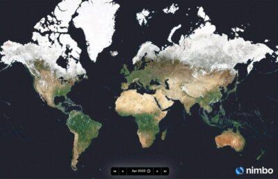
World map showing all the continents
French startup Kermap has developed a ‘digital twin’ of the Earth that claims to offer the most up-to-date views of our home planet.

The programme is called Nimbo Earth Online and it is the only platform providing new satellite views of the world every month, without clouds. Google Earth refreshes its imagery every several months to years, depending on location.

There’s one caveat though: Nimbo offers a resolution of only 10 metres per pixel. This is far less precise than what is offered by Google Earth.

But then Google Earth has really not been moving forward in leaps and bounds for the last few years. I wanted to find a specific location a few months ago, which contained a shooting range. The problem I had with Google Earth was that more than one of the recent images had cloud concealing that area. Going back in time, went too far back. Nimbo is using AI to remove the clouds. So maybe there is something with this AI-powered mapping.

Nimbo also includes a split & swipe function, which allows you to compare before and after images in one single view.

Although Nimbo states a resolution of 10 m per pixel, the interface has an HD button which says it is coming soon. So, it looks like that will improve.

But this does go to show that Google needs competition in order for them to improve. Google could have already been doing some of this AI-powered mapping if they’d felt the need to.

See https://thenextweb.com/news/digital-twin-rival-google-earth-nimbo
#Blog, #AI, #mapping, #technology

danie10@squeet.me

StreetComplete is a gamified Android app specifically for casual contributors to OpenStreetMap Editor for mapping in the field

A map prompting whether there is a cycleway at that point on the map, and of what type.
The app is made specifically for casual contributors and beginners as no prior knowledge about OpenStreetMap (such as tagging schemes) is required to contribute with this app. Furthermore, there is a bit of gamification and statistics that aim to introduce and try to inspire users to venture deeper into the world of OpenStreetMap.

This app finds missing map data in your vicinity and displays it on a map as quests. Solve each quest by visiting the location on-site and answering a simple question to update the map.

The info you enter is directly added to OpenStreetMap in your name, without the need to use another editor. OpenStreetMap is a really valuable free resource that anyone can contribute to, and which numerous mobile apps also use for their navigation. It is the Wikipedia of Mapping!

The app is open source and is available both on the Google app store but also on the F-Droid store.

See https://wiki.openstreetmap.org/wiki/StreetComplete
#Blog, #mapping, #opensource, #OpenStreetMap, #StreetComplete, #technology

danie10@squeet.me

Social mapping platform Atly launches with $18M to be a Reddit for real-world locations… But is there place in the market for more such apps?

Bild/Foto
Founded out of Israel in 2019, Atly claims to be creating the “next social paradigm for mapping and discovering places to go.” It’s all about finding new restaurants, hiking trails, bike rental places, gluten-free eateries, record stores, rooftop bars, free public toilets, and all the rest.

Through the web or mobile app, users can create their own theme-specific community, after which they become the manager for that community, including setting rules for engagement and permissions around what other users can do in that community.

According to Maslansky, Atly is not generating any revenue itself yet, but some of its users are already earning by “gating their community” to paid members.

It’s true that Google is rather slow nowadays in developing exciting new features (just look at far ahead Waze was on that front, so they got bought out), but there is also a lot to be said about “where most people are”. That “where” is often the “why” which stops users migrating off to a new service, because their contacts are all in one place and there is a mass of useful information already available. So certainly, in this regard Google Maps has pretty good reviews, ratings, photos, and other info (as does Yelp). But possibly Atly will appeal to non-Google Map users still.

But what Atly is hoping will differentiate it, is a truly more social aspect, versus just a map with lots of reviews just posted to it. The Reddit concept has worked well, but it has no geolocation / mapping type organisation.

See https://techcrunch.com/2023/05/31/social-mapping-platform-atly-launches-with-18m-to-be-a-reddit-for-real-world-locations/
#Blog, #Atly, #mapping, #places, #reviews, #technology

christophs@diaspora.glasswings.com

LUC on Twitter: "14. 'Hexagons' Yesterday's entry for the #30DayMapChallenge was made by Laura from our #GIS team 🗺️ Her map displays the #landuse and occupation of #Ukraine in the distinctive, hexagonal boardgame style of #Catan 🎲 #GISchat #maps #mapping #boardgame #tabletopgaming https://t.co/EvqaUQ1yEq" / Twitter

Impressive!

https://nitter.it/LUCtweeting/status/1592472909653708802
https://twitter.com/LUCtweeting/status/1592472909653708802

danie10@squeet.me

Immersive AI-powered view coming soon to Google Maps will raise the realism bar for mapping

Bild/Foto
Thanks to advances in computer vision and AI that allows Google to fuse together billions of Street View and aerial images to create a rich, digital model of the world — they’ve introduced a whole new way to explore with Google Maps. With their new immersive view, you’ll be able to experience what a neighborhood, landmark, restaurant or popular venue is like — and even feel like you’re right there before you ever set foot inside. So whether you’re travelling somewhere new or scoping out hidden local gems, immersive view will help you make the most informed decisions before you go.

Glide down to street level to explore nearby restaurants and see helpful information, like live busyness and nearby traffic. You can even look inside them to quickly get a feel for the vibe of the place before you book your reservation.

This is clearly a whole level above plain satellite imaging and 3D buildings. It starts rolling out in Los Angeles, London, New York, San Francisco and Tokyo later this year with more cities coming soon.

See https://blog.google/products/maps/three-maps-updates-io-2022/

#technology #googlemaps #immersiveview #mapping
#Blog, ##googlemaps, ##immersiveview, ##mapping, ##technology

danie10@squeet.me

New Interactive Tool Lets You Explore England's Hidden Archaeological Wonders From the Comfort of Home

For the last few decades, Historic England and its affiliates have been studying aerial photographs—and, in recent years, imagery from Lidar, Google Earth, and other digital sources, too—in order to catalogue historical sites across England. Now, they’ve compiled all that data into a single dazzling interactive map, free for anyone to explore online.

As Smithsonian reports, this Aerial Archaeological Mapping Explorer contains thousands of sites and covers an impressively broad swath of history, from about 6000 years ago right up through the Cold War. If little-known prehistoric hill forts are your thing, you’re in luck. There are some of those, as well as Iron Age farms, Bronze Age burial mounds, Industrial Age coal-mining sites, and much more.

See New Interactive Tool Lets You Explore England's Hidden Archaeological Wonders From the Comfort of Home

#technology #mapping #england #history #Archaeology

Imagem/foto

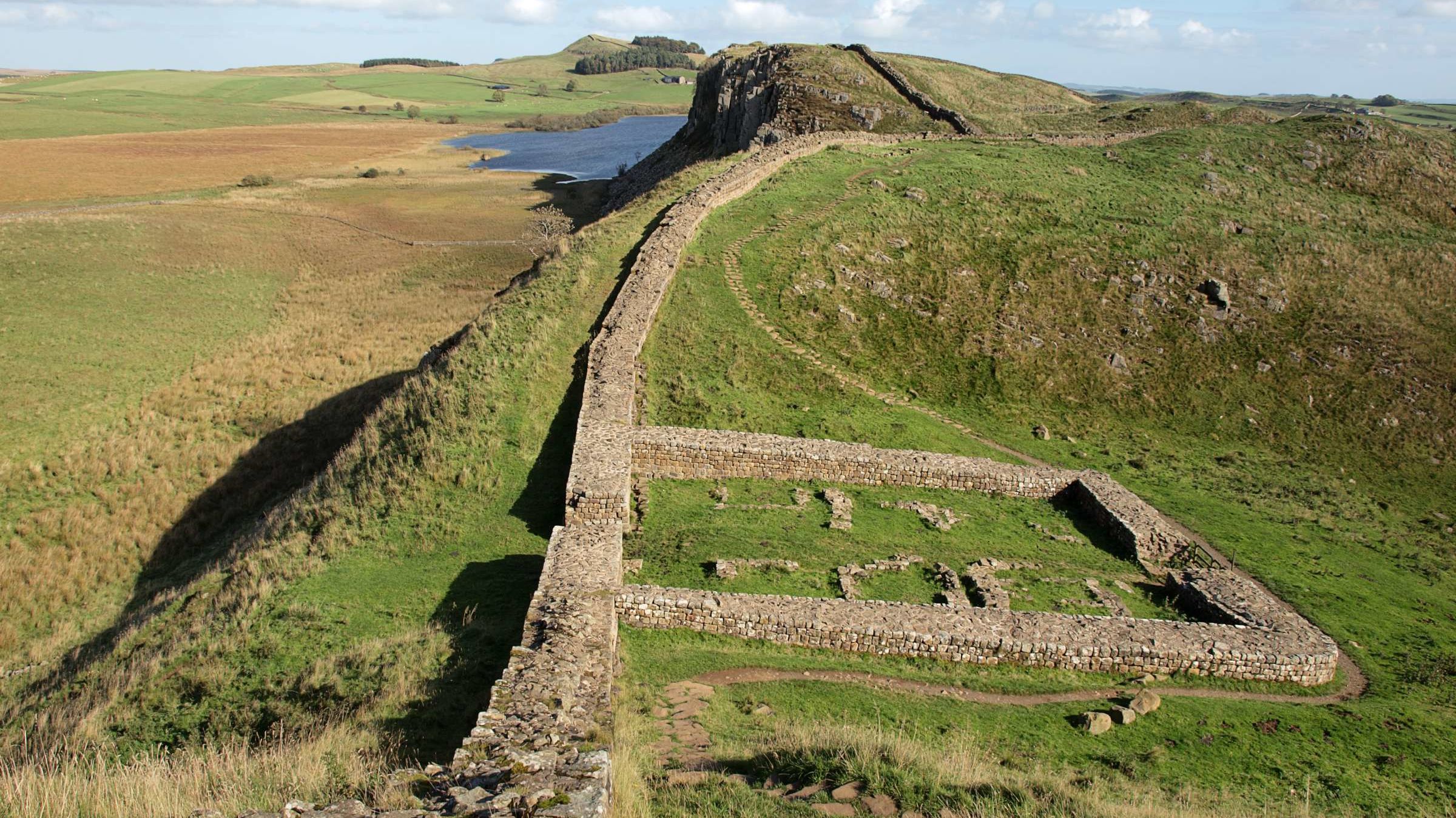
Stonehenge is there, of course. So are Iron Age farms, Bronze Age burial mounds, Industrial Age coal mines, and more.


https://gadgeteer.co.za/new-interactive-tool-lets-you-explore-englands-hidden-archaeological-wonders-comfort-home

laurentb@diaspora-fr.org

CartNat : Une Cartographie du gradient de naturalité potentielle de France métropolitaine

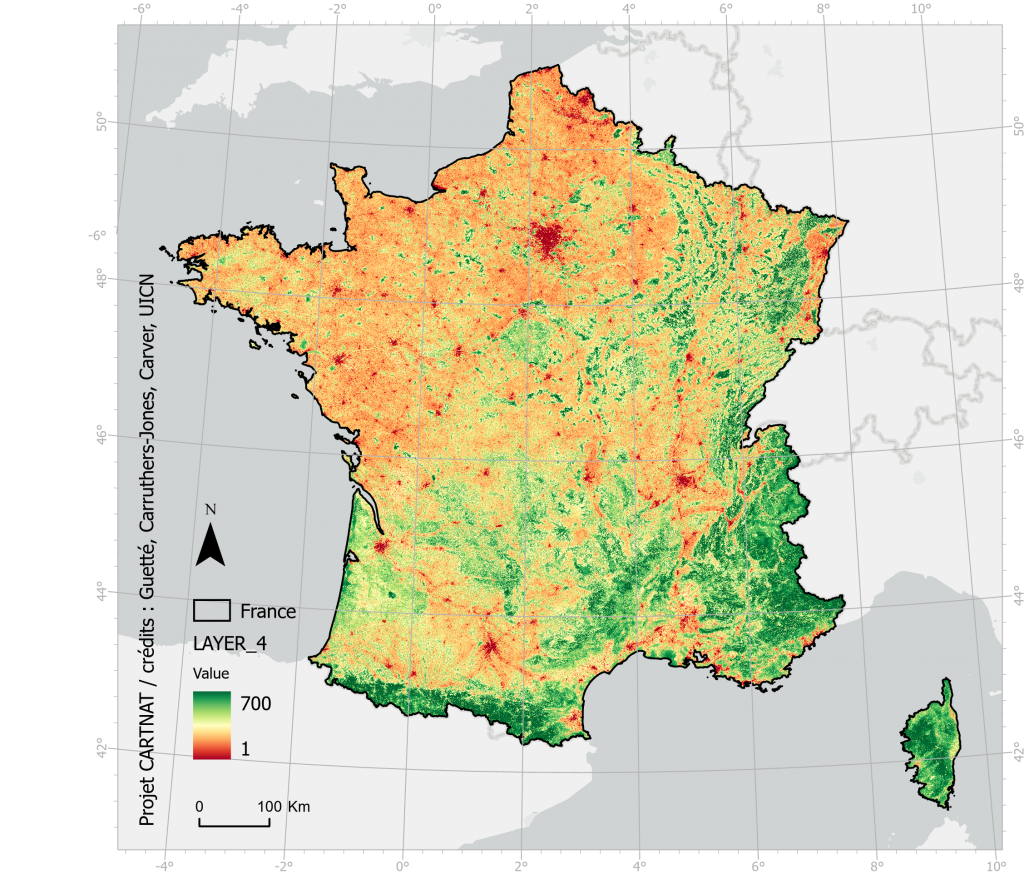
Projet CARTNAT

Le projet CartNat vise à développer une méthode de cartographie de la naturalité potentielle. Ces travaux ont abouti en 2021 pour la France métropolitaine terrestre et les cartographies produites consistent en 4 couches spatiales :

  1. L’intégrité biophysique de l’occupation du sol
  2. La spontanéité des processus
  3. Les continuités spatiales
  4. La carte synthétique du gradient de naturalité potentielle à partir des critères 1 à 3

Les cartographies sont aujourd’hui mises à disposition (format ESRI Geodatabase – 2.3 GB) et la notice technique qui les accompagne décrit la méthodologie appliquée.

#uicn #cartographie #sig #naturalité #nature #wilderness #mapping #gis #france #géographie #geography

danie10@squeet.me

StreetComplete is an open source open street map (OSM) editor used for mapping in the field while on an Android phone, with quests

This phone app is great for a couple of reasons, the first being the entertainment you can find during day-to-day adult tasks or if you want just to have a socially distant date where you drive around and do quests for the night.

The second reason is that it gives everyone the chance to contribute to open source, no matter how small the experience. This can open the door for many people to discover a new world they didn't know existed. While many other apps work with OSM, this one is the most entertaining and gives you something new to do while you're out and about for the day.

See Contribute to OpenStreetMap from your phone

#technology #opensource #streetcomplete #navigation #mapping

Image/photo

StreetComplete is an open street map editor used for mapping in the field while on an Android phone.


https://gadgeteer.co.za/streetcomplete-open-source-open-street-map-osm-editor-used-mapping-field-while-android-phone-quests

danie10@squeet.me

This month is the 17th birthday of OpenStreetMap (OSM), a community-owned collaborative geographic database of the world

This cool database was inspired by the success of Wikipedia and the (rather annoying) predominance of proprietary map data. With over two million registered users and growing, many collect and provide data from GPS devices or local knowledge of the mapping area. OSM also has established a model for non-governmental organizations to collaborate with international organizations. A notable example of this, during the 2010 Haiti earthquake, OSM and Crisis Common volunteers using available satellite imagery to map the roads, buildings, and refugee camps of Port-au-Prince in just two days built the most complete digital map of Haiti's roads. This is known as Crisis mapping and is a real-time way to have people contribute and create situational awareness of the surroundings for the citizens and any humanitarian aid groups.

You can do your bit too by checking your local area and submitting updates and changes.

See What I love about OpenStreetMap

#technology #mapping #navigation #opensource #OSM

Image/photo

This month is the 16th birthday of OpenStreetMap (OSM), a community-owned collaborative geographic database of the world.


https://gadgeteer.co.za/month-17th-birthday-openstreetmap-osm-community-owned-collaborative-geographic-database-world

garryknight@diasp.org

OpenStreetMap looks to relocate to EU due to Brexit limitations | Brexit | The Guardian

OpenStreetMap, the Wikipedia-for-maps organisation that seeks to create a free and open-source map of the globe, is considering relocating to the EU, almost 20 years after it was founded in the UK by the British entrepreneur Steve Coast.
OpenStreetMap Foundation, which was formally registered in 2006, two years after the project began, is a limited company registered in England and Wales. Following Brexit, the organisation says the lack of agreement between the UK and EU could render its continued operation in Britain untenable.

#technology #tech #internet #mapping #GIS #Brexit

https://www.theguardian.com/politics/2021/jun/30/openstreetmap-looks-to-relocate-to-eu-due-to-brexit-limitations