
#openstreetmap
10.08.2024 Happy Birthday OSM
Täglich die Welt verbessern
Gestern hatte das weltweite Projekt Open Street Map (OSM) den 10. Geburtstag gefeiert. Am 9. August 2004 wurde die Domain für das Kartenprojekt registriert.
Eine Karte für die ganze Welt und das als freies offenes Projekt im Besitz aller Menschen. Das war damals kaum vorstellbar, aber es hat bis heute geklappt. Seit 2010 sind auch Aktive von Aktion Freiheit statt Angst e.V. dabei. Anfangs wurde schnell aus einem Punkt auf der Landkarte ein Ort mit Straßen, Geschäften, Sehenswürdigkeiten, inzwischen sind es die AddOns, wie Bäume, Toillettenhäuschen, Recycling-Container u.v.m.
Bereits 2010 reklamierte das Projekt die Stadt Hamburg (fast) vollständig kartografiert zu haben. Inzwischen ist OSM weltweit (fast) flächendeckend verfügbar. Der Vorteil gegenüber den käuflichen Produkten liegt nun gerade an der besseren Qualität und schnelleren Aktualisierung, denn die Nutzer greifen stets auf den aktuellen Status zu, während man bei gekaufter Software erst ein Updaten bestellen muss - und dazu oft den Kauf nachweisen muss.
Heise.de verweist auch auf die 1. Hilfe Funktion von OSM nach Katastrophen, denn schnell sind die vor Ort Aktiven von OSM dabei und bringen die Veränderungen, z.B. nach dem schweren Erdbeben in der Türkei vor einem Jahr, in die Karte ein und unterstützen damit die Hilfsorganisationen.
Inzwischen ist das Vertrauen in die Korrektheit von OSM Kartenmaterial auch so groß, dass Verlage sie für Spezialkarten, z.B. für Radfahrer und die Anbieter von ÖPNV sie zur Darstellung ihrer Online Fahrpläne nutzen. Auch das Navigieren für Fußgänger, Radfahrer und auch Autos ist mit vielen Zusatzprogrammen, wie z.B. OSMand verlässlich möglich.
Wir gratulieren diesem Open Software Projekt - und nutzen sie natürlich auch selbst, z.B. zur Darstellung der Orte in unseren Terminen ...
Mehr dazu bei https://www.heise.de/hintergrund/20-Jahre-OpenStreetMap-Auf-Augenhoehe-mit-Google-Maps-und-Apple-Maps-9829308.html?seite=all
Kategorie[17]: Presse Short-Link dieser Seite: a-fsa.de/d/3C9
Link zu dieser Seite: https://www.aktion-freiheitstattangst.org/de/articles/8867-20240810-happy-birthday-osm.html
Link im Tor-Netzwerk: http://a6pdp5vmmw4zm5tifrc3qo2pyz7mvnk4zzimpesnckvzinubzmioddad.onion/de/articles/8867-20240810-happy-birthday-osm.html
Tags: #OpenStreetMap #GPS #OSM #weltweit #Geografie #Verfügbarkeit #OpenSource #Transparenz #Informationsfreiheit #Smartphone #Handy #Verhaltensänderung
#openstreetmap.org…
… ist ja toll, aber wieso wollen die wissen ob ich ein #Mensch bin und schwupp, klappt nix mehr.
Ich warte
Ich warte
Ich warte
Ich trinke Kaffee
Ich warte
…
📍 Karten öffentlicher Tischtennis-Platten 🏓 (PingPongMap, OpenStreetMap, uMap)
#PingPongMap pingpongmap.net/
(Info via @Tifi )

....schade, dass die “PingPongMap” wohl keine #OpenStreetMap -Basis hat und auch die Angaben von #OSM nicht ergänzend nutzt. Eine Kombination aus beidem wäre m.E. optimal: die PingPongMap, die auch zu den Orten Bilder und “Bewertungen” der Platten enthält, und die OSM-Daten, die für die meisten Regionen ziemlich vollständig sein sollten. Exemplarisch für #Wuppertal ist auch zu sehen, dass in OSM einige TT-Orte dabei sind, die in der PingPongMap aber fehlen.
Auf dieser Karte von @MapComplete sind die #Tischtennis-Orte zumindest schön mit einem 🏓-Symbol dargestellt und gut zu finden: mapcomplete.org/sport_pitches?…

Eine #OverpassTurbo -Abfrage findet gezielt #Tischtennis -Orte in den #OpenStreetMap -Daten (links obenn auf „Ausführen“ klicken): overpass-turbo.eu/s/1sld
(via @kdkeller )

Auf #uMap sind regionale Karten für #Insbruck #Berlin & #Dresden zu finden: umap.openstreetmap.fr/de/searc…

Habt Ihr Erfahrungen damit? Kennt Ihr noch weitere Karten, die Tischtennis-Orte anzeigen?
[Repost wg. Umzug der 🏓 #Tischtennis -Community von #fedditDe auf #fedditOrg = tischtennis@feddit.org - Der alte Post + Antworten auf feddit.de sind u.a. noch hier zu sehen: alexandrite.app/feddit.de/post…
// @PuschyMTB 🚴♂️🚩 @Guido Gallenkamp @Tischtennis
Geile Scheiße
Post und DHL wechseln von Google Maps zu Openstreetmap
Die Deutsche #Post und auch #DHL nutzen #Google #Maps nicht mehr länger bei der #Paketverfolgung. Stattdessen setzen sie auf #Kartenmaterial von #Openstreetmap.
Natürlich nur wegen des Geldes und nicht weil die Post plötzlich Open Source für sich entdeckt hat. Bleibt zu hoffen daß sich das ändert und sie hilft, das Kartenmaterial zu verbessern.

#Post #DHL #OpenStreetMap #OSM #NoGoogle #Datenschutz
♲ Norbert Tretkowski - 2024-04-14 13:02:45 GMT
Post und DHL wechseln von Google Maps zu #OpenStreetMap
golem.de/news/paketverfolgung-…


GIS software company ESRI is shutting down internal conversations about whether or not their products are being used by the Israel Defense Forces - from an employee
EDITORIAL NOTE: Further reason to use FOSS4G? This report is uncorroborated, but seems to square with Environmental Systems Research Institute Inc's policies.
Throwaway account--trying to post in a few subs because I think this is important.
For those who don't know, ESRI creates Geographic Information Systems software. This software is used for making maps and spatial analysis, among other things. If you work in GIS, or use maps, you've probably used this software. Now for the important part.
On Monday, December 11, 2023, an employee posted in the HR Teams channel to ask the question: "Is the Israeli Defense Force (IDF) using ArcGIS to help with the current bombings in Gaza?" The employee went on to explain that they had reached out to HR with this question and was told that "the specific information you are requesting is not going to be supplied to you. We would need permission from a distributor or customer to provide specific information about products sold or used and we don't have said permission."
The employee went on to explain that they thought it was important for ESRI employees to know this information. The employee also inquired if others were concerned and wanted answers. The employee also pointed out that ESRI had taken a political stand previously with regard to Ukraine and Russia and provided a screenshot of an official ESRI statement that said: "Esri stands in solidarity with Ukraine and the Ukrainian people. Our software is not and will not be deployed in any military or intel organization in Russia. Esri distributor CIS is curtailing sales in Russia. We are actively supporting the humanitarian efforts in Ukraine, and we continue to work with many European countries, as well as NATO, the United Nations, and the US State Department. Esri will do everything we can to help Ukraine and its people."
The post garnered a lot of attention and support from other employees. Several responded that they were concerned that ESRI is providing software for a genocide. The specific word "genocide" was used a few times. There was one dissenting comment.
On Wednesday, December 20, 2023, another employee commented on the thread to say that the original poster had resigned on Friday, December 15, 2023, due to "lack of answers from the administration."
Later that day, an email was sent out about a new policy with regard to the digital environment and appropriate business conduct.
Today, December 21, 2023, the entire thread and all of the responses were deleted, presumably by HR, since they manage the channel. An HR team member replied and said that "there were many posts involving sensitive topics and comments that were not appropriate for a business setting. I have received numerous inquiries and employees stating that they feel uncomfortable with the messaging and tone in these posts." Meanwhile, a separate post in the same channel, made on October 15, 2023, titled "Condemning the terrorist attacks in Israel" stayed up. It would seem that ESRI is not concerned with the discomfort of their Palestinian employees.
I am an ESRI employee and I am furious. ESRI talks about their commitment to making the world a better place while shutting down conversations by their employees about genocide. I don't think it's a secret that ESRI operates this way, but I wanted to share what's happening on the inside. Many of us are angry and we won't be silenced.
#Shaban1445 #GIS #Israel #ArcGIS #war #antiwar #technology #Gaza #Palestine #warcrimes #genocide #Esri #BDS #OSM #FOSS4G #openstreetmap #opensource #ethics #corporateethics #politics #ukraine #russia #rothschildistan #map #mapping #countermapping #cartography #geospatial #geography
#military #militarytechnology #QGIS #GRASSGIS #IDF #IOF

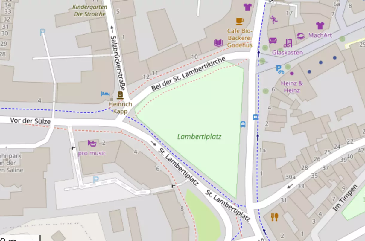
Heute: 20.01.2024 -> #Lüneburg -> Lambertiplatz 16:00 Uhr
Ich werde mich heute aus meinem "Dorf-Schloß" in die nächst größere Stadt begeben und mein Statement zum Thema abgeben. Ich muß ganz ehrlich zugeben, daß mich die bundesweiten Demos positiv überrascht haben. Hätte nicht erwartet, daß sich nochmal soviel Anstand formiert (könnte aber gern noch mehr sein). Solltet ihr in der Nähe sein, dann kommt vorbei. <3
Karte via #OpenStreetMap: https://osm.org/go/0G9tZoatZ--
#Antifa #Antifaschistische-Aktion #NoNazis #NoAfD #NoWerteunion #NoCDU #Demo ☮️
@free open source
♲ OpenStreetMap - 2024-01-13 15:00:38 GMT
OpenStreetMap data is free, we only ask that you tell people about us in exchange¹.Some site use OSM without attribution, *and* hotlink to OSMF tile servers. 😭 Our data is free, but our servers cost time & money. 🖥 It's now even easier for you to report naughty sites like that. 📝 They can (eventually) be blocked from freeloading. We hope this will increase visibility of OSM! 👍 🎉
Read more: https://github.com/openstreetmap/tile-attribution/blob/main/README.md
#OpenStreetMap #OSM
¹ to simplify the OSM licence req's.
LibRedirect
A web extension that redirects YouTube, Twitter, TikTok, and other websites to their alternative privacy friendly frontends.
Great project names to find: Urban Dictionary → Rural Dictionary
YouTube → Invidious, Piped, Piped-Material, PokeTube, CloudTube, Tubo, FreeTube, Yattee, FreeTube PWA
YouTube Music → Beatbump, Hyperpipe
Twitter → Nitter
Bluesky → skyview
Reddit → Libreddit, Teddit
Tumblr → Priviblur
Twitch → SafeTwitch, Twineo
TikTok → ProxiTok
Instagram → Proxigram
IMDb → LibreMDb
Bilibili → MikuInvidious
Pixiv → PixivFE
Fandom → BreezeWiki
Imgur → Rimgo
Pinterest → Binternet
Soundcloud → Tubo
Bandcamp → Tent
Tekstowo → TekstoLibre
Genius → Dumb
Medium → Scribe, LibMedium
Quora → Quetre
Github → Gothub
Gitlab → Laboratory
Stack Overflow → AnonymousOverflow
Reuters → Neuters
Snopes → Suds
Urban Dictionary → Rural Dictionary
Goodreads → BiblioReads
Wolfram Alpha → WolfreeAlpha
Instructables → Indestructables, Destructables
Wikipedia → Wikiless
Wayback Machine → Wayback Classic
Search → SearXNG, SearX, Whoogle, LibreX, 4get
Translate → SimplyTranslate, Mozhi, LibreTranslate
Google Maps → OpenStreetMap
Meet → Jitsi
Send Files → Send
Paste Text → PrivateBin
#libredirect #youtube #invidious #piped #poketube #cloudtube #tubo #freetube #yattee #beatbump #hyperpipe #twitter #nitter #bluesky #skyview #reddit #teddit #libreddit #tumblr #priviblur #twitch #safetwitch #twineo #tiktok #proxytok #instagram #proxigram #imdb #libremdb #bilibili #mikuInvidious #pixiv #pixivfe #fandom #breezewiki #imgur #rimgo #pinterest #binternet #soundcloud #tubo #bandcamp #tent #tekstowo #tekstolibre #genius #dumb #medium #scribe #libmedium #quora #ouetre #github #gothub #gitlab #laboratory #stackoverflow #anonymousoverflow #reuters #neuters #snopes #suds #urbandictionary #ruraldictionary #goodreads #biblioReads #wolframalpha #wolfreealpha #instructables #indestructables #destructables #wikipedia #wikiless #waybackmachine #waybackclassic #search #searxng #searx #whoogle #librex #4get #translate #simplytranslate #mozhi #libretranslate #googlemaps #openstreetmap #meet #jitsi #sendfiles #send #pastetext #privatebin
Prenez un (excellent) smartphone Crosscall étanche et solide, en charge sur son support moto.
Suivez les indications d'un (excellent) GPS open source OsmAnd , respectueux et précis
Vous arrivez à bon port en Bretagne, même sous la tempête de samedi dernier !
Ajouté Coyote pour les dangers de toute sorte, la route est sûre !
Merci à eux pour la qualité de leurs productions
#Google is trying again to convince you, YES YOU, to contribute for free to Google Maps.
Please don't.
It is 100% #proprietary, Google has full control over the data you added and people can only access Google Maps over proprietary channels where Google dictates the rules. This gives them too much power.
Contribute to #OpenStreetMap instead, it's a project by the community, for the community.
Habt Ihr vielleicht Empfehlungen für Tools bzw. Anleitungen, mit denen für eine Veranstaltung eine #OpenStreetMap -Karte mit (vielen) Markern erstellt werden kann?

Aktuell geht es um eine Empfehlung für jemanden, der bislang voll von #Google und #GoogleMaps überzeugt ist, Details s.u.
Ad hoc habe ich bspw. dieses Tool gefunden, aber vielleicht habt Ihr weitere/andere Empfehlungen?
vielleicht auch #uMap ?
Zum Hintergrund:
Am Wochenende gab es hier in #Köln eine sehr schöne Veranstaltung. Die Karte dazu war leider auf Google-Basis und stellte sich für mich so dar (s. Bild 1):

Ich habe daraufhin den Veranstalter per Mail angeschrieben (Betreff: "Karte funktioniert nicht - ... Wäre es nicht besser für solche Zwecke ein zuverlässigeres Tool wie bspw. OpenStreetMap zu verwenden?")
Auf den Vorschlag wurde nicht eingegangen, nur ein anderer Browser empfohlen. Aber im Nachgang kam nun noch die Meldung "irgendwann lief es auch bei mir nicht mehr - die Einbindung von Google-Karten muss man bezahlen, es kann sein, dass gestern das „Account-Limit“ dort gesprengt wurde aufgrund der vielen Zugriffe."
Nach der Erfahrung wäre ja vielleicht doch Bereitschaft für Alternativen da und da würde ich gerne was Konkretes empfehlen können, das aber möglichst einfach funktionieren sollte und niedrigschwellig umsetzbar ist.
#OpenStreetMap #OSM #uMap #DeGoogle
// cc @𝓒𝓱𝓻𝓲𝓼 @Hey, Alter! Köln e.V. @crossgolf_rebel on Calckey :firefish:
Hallo zusammen,
ich habe eine kleine Befragung zum Thema "Karten-Apps & Navigation" 🗺️ 📍 erstellt und lade Euch hiermit 🧡lich zur Teilnahme an der Befragung ein. Die Umfrage beinhaltet (maximal 10) Fragen zu #KartenApps im Allgemeinen und zu #OpenStreetMap im Besonderen.
Die Umfrage dauert nur wenige Minuten und ist anonym. Es werden keinerlei personenbezogene Daten erhoben, alle Angaben sind freiwillig. Die Ergebnisse werden in zusammengefasster Form auf gnulinux.ch veröffentlicht.
Über den folgenden Link kommst Du direkt zur Befragung:
👉 https://cryptpad.digitalcourage.de/form/#/2/form/view/2hCqKwX6AoKaP6knPb1rzRPRObOJXWGOVEqb0dnGv2s/
Teile gerne diesen Beitrag für die breitere Verteilung im #Fediverse! 🚀 #BoostOk #BoostWelcome
Gerne kann der Link zur Befragung auch auf anderen Kanälen geteilt werden. Danke!
Die Umfrage ist über #Cryptpad Formular realisiert und lädt evtl. relativ langsam.
#Umfrage #Befragung #Poll #Maps
#GoogleMaps #AppleMaps #BingMaps #Komoot #MagicEarth #OrganicMaps #OpenStreetMap #OSM

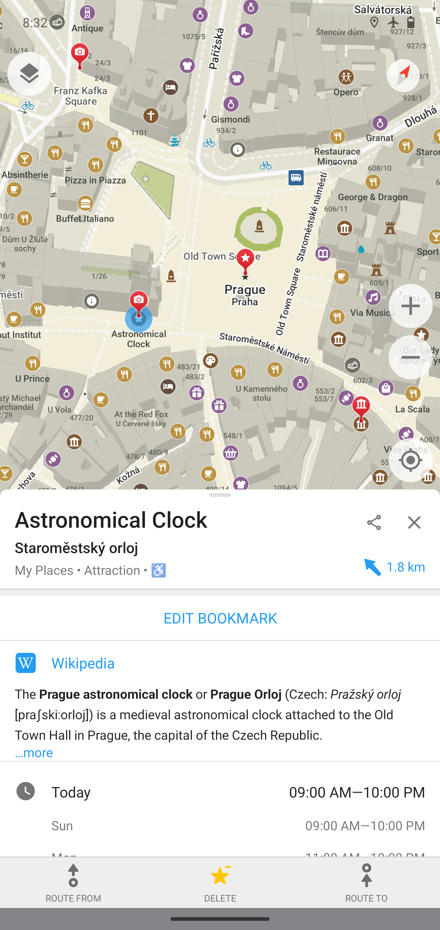
🗺️ 📍 OpenStreetMap-Daten einfach bearbeiten mit Organic Maps und StreetComplete
Ich nutze ja schon länger #OrganicMaps und empfehle die App auch immer wieder als einfache Karten- und Navigations-App, die #OpenSource, auf #OSM -Basis ist und auch offline genutzt werden kann. Also eine schlankere Alternative zu #OSMand : https://gnulinux.ch/organic-maps
Erst heute habe ich aber per Zufall von @Tifi erfahren, dass mit Organic Maps auch sehr einfach OSM-Daten ergänzt und bearbeitet werden können :
. Einmal eingeloggt, lassen sich Einträge super einfach bearbeiten.")
"Einfach draufdrücken, hochziehen & bearbeiten. Beim ersten Mal wird darauf hingewiesen, dass es einen OSM-Account braucht (inkl. Link zur Registrierung). Einmal eingeloggt, lassen sich Einträge super einfach bearbeiten. (...) Neue Orte lassen sich ebenfalls durch langes drücken auf die gewünschte Stelle hinzufügen." Geht wirklich supereinfach!
@Organic Maps : Vielleicht habe ich was übersehen, aber auf Eurer Homepage könnte die Funktion auch zumindest erwähnt werden? https://organicmaps.app/de/ - ich finde es eine tolle Sache, auch wenn die meisten die Funktion nicht brauchen.
Eine weitere schöne Option, um zu OpenStreetMap beizutragen, ist #StreetComplete: Ein wirklich sehr einfacher und auch unterhaltsamer Weg, um sich am #OpenStreetMap -Projekt sinnvoll zu beteiligen.
"Diese App findet fehlende Kartendaten in deiner Nähe und zeigt diese als Aufgaben auf einer Karte an. Jede dieser Aufgaben kann vor Ort durch Beantwortung einer einfachen Frage gelöst werden." https://streetcomplete.app/
"Es gibt vielfältige Herausforderungen zu lösen. Tippt man dann auf das dementsprechende Pin, stellt die App dann eine Frage. Meist handelt es sich um Multiple-Choice-Fragen oder Eintippen von Ergänzungen. Die Fragen sind dabei grafisch ansprechend und mit Abbildungen versehen. (...) Ein Beispiel dazu: Ich tippe auf einen Pin mit einem Uhrensymbol. Mögliche Fragen sind dann die Öffnungszeiten eines Geschäftes, oder ob diese noch stimmen.
Es gibt Fragen zu Straßennamen, Hausnummern, Untergründen und Parkplätzen - um nur einige Beispiele zu nennen. Selbst Standorte von Mülleimern oder Pollern werden hinterfragt. Die Aufgaben sind so vielfältig" https://gnulinux.ch/streetcomplete
Auch diese App gibt es natürlich bei #FDroid: https://f-droid.org/packages/de.westnordost.streetcomplete/
@StreetComplete News & Support

StreetComplete is a gamified Android app specifically for casual contributors to OpenStreetMap Editor for mapping in the field

The app is made specifically for casual contributors and beginners as no prior knowledge about OpenStreetMap (such as tagging schemes) is required to contribute with this app. Furthermore, there is a bit of gamification and statistics that aim to introduce and try to inspire users to venture deeper into the world of OpenStreetMap.
This app finds missing map data in your vicinity and displays it on a map as quests. Solve each quest by visiting the location on-site and answering a simple question to update the map.
The info you enter is directly added to OpenStreetMap in your name, without the need to use another editor. OpenStreetMap is a really valuable free resource that anyone can contribute to, and which numerous mobile apps also use for their navigation. It is the Wikipedia of Mapping!
The app is open source and is available both on the Google app store but also on the F-Droid store.
See https://wiki.openstreetmap.org/wiki/StreetComplete
#Blog, #mapping, #opensource, #OpenStreetMap, #StreetComplete, #technology
Gerade #PhoneTrack für #Nextcloud entdeckt, einfache Möglichkeit vom #Handy direkt auf den Homeserver zu loggen wo man gerade ist, dass geht bspw. mit #GPSLogger.
Das ganze kann man dann in Nextcloud in #OSM anschauen.
Ich hab es in 5 Minuten am laufen gehabt und musste nicht groß rumprobieren, werde es mal für paar Stunden anlassen und morgen wenn ich unterwegs bin ebenfalls mal.
#Handy #GPS #GPSLogger #OpenStreetMap
PhoneTrack: https://apps.nextcloud.com/apps/phonetrack
GPSLogger: https://f-droid.org/de/packages/com.mendhak.gpslogger/
Magic Earth: A New Google Maps Alternative Launches on Android Auto based on OpenStreetMap

Magic Earth now supports Advanced Driver Assistance System (ADAS) systems powered by the phone’s camera. The application can monitor the road ahead and provide functionality otherwise available in integrated ADAS technology fitted into the car. The application offers lane departure warnings, traffic sign recognition, and forward and pedestrian collision notifications.
The navigation application, which retains its focus on user privacy and offline route guidance, also brings most features to Android Auto. Magic Earth now supports truck navigation, letting users enter vehicle information. For example, the application can look for routes based on certain vehicle parameters, such as width, height, length, weight, and axle weight. Once all these details are provided, Magic Earth only configures appropriate routes, avoiding narrow roads, low bridges, and sharp curves.
I tested it out today, but in my case, the version I just downloaded did not yet recognise Android Auto. Just like OsmAnd it is based on OpenStreetMap. It has a much simpler, but I’d say better looking, interface than OsmAnd. Any new interface of course takes a bit of time to get used to. OsmAnd does also have all the truck navigation features previously mentioned, and it has a ton more settings and options (for example also speed bump and pedestrian crossing warnings), but many may find OsmAnd a bit more complex. If so, then Magic Earth may be well worth trying out.
Magic Earth says they are privacy first with no tracking, no profiling, don’t trade in our personal data, and don’t have our personal data.
It does have options for traffic and re-routing (and I’m not sure how the traffic data is working) but I suppose the proof of the pudding for many will be, how well does it route in real life. You can however also tweak these settings for cars, bicycles and walking (I imagine trucks is in the newer version I don’t seem to have yet).
See https://www.autoevolution.com/news/a-new-google-maps-alternative-launches-on-android-auto-with-massive-update-214097.html
#Blog, #MagicEarth, #navigation, #OpenStreetMap, #privacy, #technology